
Satellite imagery released in response to Libya flooding
September 25, 2023
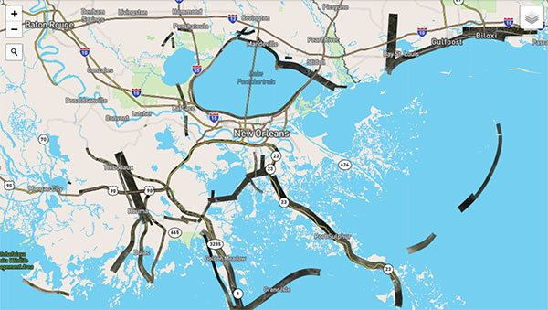
Floodwaters overpowered dams and wiped out entire neighborhoods in eastern Libya, taking the lives of thousands of people and displacing more than 40,000 people
Read More
Floodwaters overpowered dams and wiped out entire neighborhoods in eastern Libya, taking the lives of thousands of people and displacing more than 40,000 people

CHC Navigation has released the C5 and C30 orthographic and oblique cameras for aerial surveys. The systems […]

Birmingham City Council has launched a mapping portal, created by Bluesky International, to address the issue of tree equity across the city.

Bluesky International and SkyFi have collaborated to provide access to Earth observation assets and multi-perspective imagery to users globally.

EagleView Technologies is enhancing EagleView Cloud for government users by adding more imagery options. EagleView Cloud is a resource for government departments including tax assessment, geographic information systems and public safety.
Aerial mapping provides a competitive advantage for AEC companies to win their fair share of the $17 billion infrastructure bill.
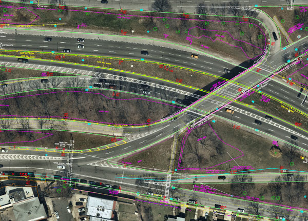
Aerial mapping provides a competitive advantage for AEC companies to win their fair share of the $17 billion infrastructure bill.
Applanix, a Trimble Company, and the National Oceanic and Atmospheric Administration (NOAA) have collaborated to provide critical information […]


Follow Us