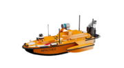
January 20, 2026 CHC Navigation releases Apache 6 USV for high-resolution marine surveying By Tracy Cozzens
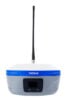
January 12, 2026 CHC Navigation brings PointX and StellaX positioning to smart lawn mowing By Tracy Cozzens
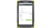
November 24, 2025 New data collection and mobile mapping software used in surveying and mapping projects By Jesse Khalil
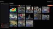
July 8, 2025 CHCNAV’s cloud-based platform enhances 3D data processing and collaboration By Jesse Khalil