CHC Navigation introduces Apache3 marine drone
May 11, 2020
Highly cost-effective autonomous marine drone for bathymetric surveys The new Apache3 Marine Drone — 2020 Edition provides a […]
Read More

Highly cost-effective autonomous marine drone for bathymetric surveys The new Apache3 Marine Drone — 2020 Edition provides a […]

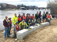
The U.S. Geological Survey (USGS) and independent scientists gathered this month in Auburn, Maine, to evaluate the use […]

The Ribble River flowing through Preston in Lancashire, United Kingdom, has hidden depths. “The challenge with rivers is […]

A new high-accuracy technique using one dual-frequency GNSS receiver, precise point positioning (PPP) offers the possibility of cost-effectively obtaining coordinates. This study investigates the accuracy of kinematic PPP for hydrographic applications on rivers, and shows results comparable to double-difference solutions.

Geography Paints Both Rosy and Grim Picture of the World
As a graduate student in the late ’80s I was learning about “New Geography” using a cutting-edge technology called GIS. It’s easy to focus on the technology aspects of GIS and forget the reason for our tradecraft. I was reminded of that reason when I read The Accidental Superpower by Peter Zeihan. It effectively uses geography and analytics to explain how the world has been shaped and is evolving.

The Utah Division of Wildlife Resources (DWR) is using rugged Juniper Systems handhelds in an innovative way: to […]

Field & Stream called it a “…very cool tool and quite a bit of fun.” MinnPost described it […]
Follow Us