Woolpert wins Google Cloud LBS Partner of the Year award
April 6, 2020
Woolpert has received the 2019 Google Cloud Specialization Partner of the Year award for location-based services. Woolpert was […]
Read More

Woolpert has received the 2019 Google Cloud Specialization Partner of the Year award for location-based services. Woolpert was […]

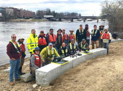
The U.S. Geological Survey (USGS) and independent scientists gathered this month in Auburn, Maine, to evaluate the use […]

Woolpert has signed a five-year, multimillion-dollar Geospatial Product and Services Contract 3 (GPSC 3) with the U.S. Geological […]
Teledyne Optech‘s ALTM Titan lidar sensor earned the 2015 Grand Award in the ninth annual MAPPS Geospatial Products and Services […]

The Japan District of the U.S. Army Corps of Engineers has awarded the Woolpert-KZF Joint Venture (W-KZF JV) […]

The U.S. Geological Survey (USGS) has contracted with Woolpert to evaluate new lidar (light detection and ranging) technologies to […]
Follow Us