GeoSLAM partners with Flyability on Elios 3 indoor drone
June 29, 2022
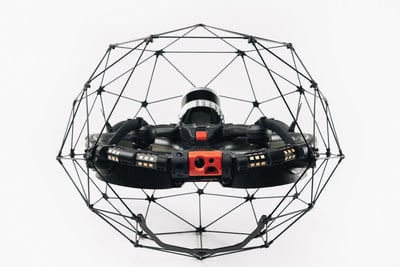
Flyability has unveiled the Elios 3, a collision-tolerant drone equipped with a lidar sensor for indoor 3D mapping. […]
Read More
Flyability has unveiled the Elios 3, a collision-tolerant drone equipped with a lidar sensor for indoor 3D mapping. […]
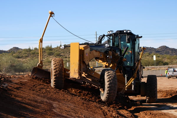
Buesing was one of the early adopters of machine control in 2006. The company started with the Trimble GCS900 on single-mast and dual-mast blades, excavators and dozers.

Team Provides Accurate 3D Maps for Smart City Applications According to 2019 statistics, more than 10,000 residential buildings […]
SimActive’s Correlator3D software is being used by by Dutch company NEO B.V. to assess solar potential in multiple […]

The mysterious and fascinating Kame of Isbister is situated in Shetland’s north mainland near the North Roe. The […]

Aerial imagery company Nearmap has acquired technology and assets from Pushpin, a deep learning and analytics technology company […]

Trimble has introduced its Trimble SiteVision system, an outdoor augmented reality (AR) solution that enables users to visualize […]

Terra Drone Europe, a group company of Terra Drone Corporation, has completed an aerial 3D survey and produced […]


Follow Us