No audio available for this content.
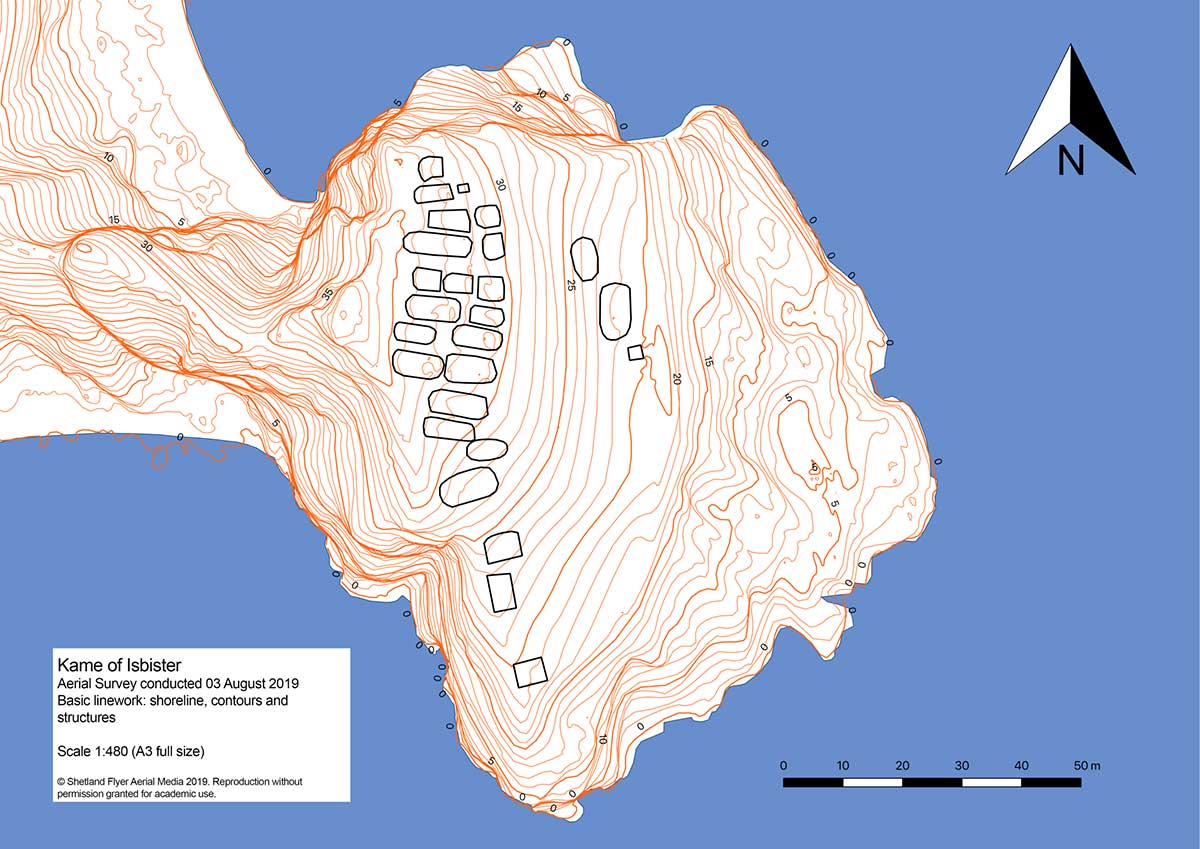
The mysterious and fascinating Kame of Isbister is situated in Shetland’s north mainland near the North Roe. The location has been studied several times, including by the Extreme Archaeology TV series in 2003. The uninhabited grassland continues to attract explorers because of a series of secret structures.
Those structures are hidden on the sea-faced slope and can’t be seen from the land nearby. One theory posits that it’s an eremitical monastery settlement. The late Pictish/early Medieval site is hard to access — and that’s where drones coupled with GNSS receivers helped explorers.
In 2019, Shetland Flyer Aerial Media in collaboration with Shetland College UHI and the Institute for Northern Studies explored the site. Their goals: create a 3D model of the headland as well as an orthomosaic and digital terrain model to identify and map the monastery structures.
Because the site is hard to access, the team decided to use the DJI Phantom 4 RTK SUA (drone and base) with two flights. One flight captured both the Kame and a piece of the mainland for context, with a ground sample distance (GSD) of 2.4 centimeters/pixel (cm/px). The second flight was on a shorter GSD of 1.9 cm/px to capture detailed pictures of the cape and structures.
Before the survey, the team used the Emlid Reach RS+ real-time kinematic (RTK) receiver to identify and establish the base mark for the drone on the mainland nearby.
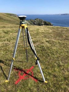
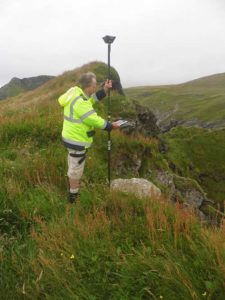
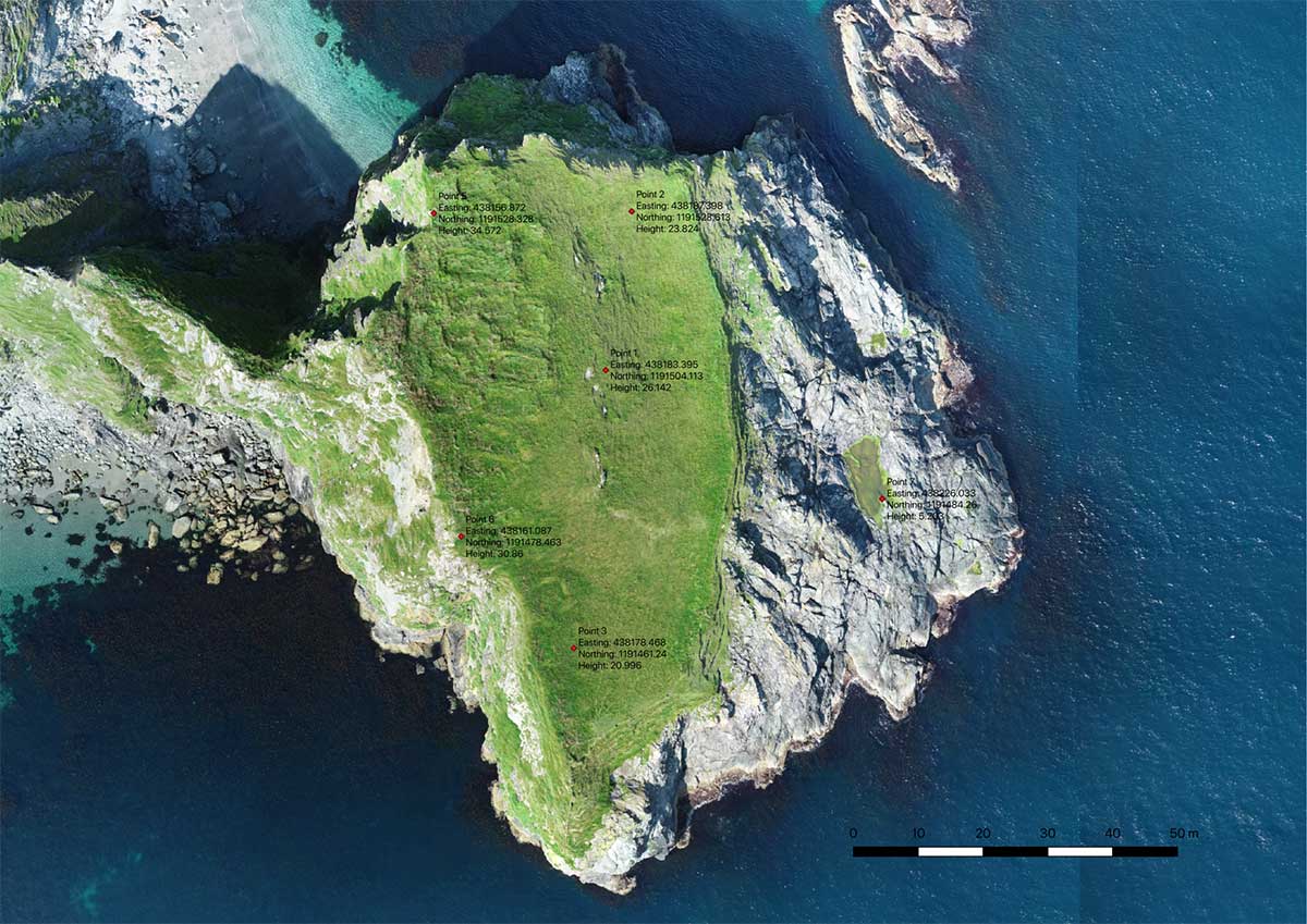
The base mark was then post-processed using data from the OS Net reference station in Lerwick. Considering the long baseline (52 kilometers), it took the team four hours to observe the mark with Reach RS+. Later, when the archaeologists managed to climb the headland, the RTK receiver collected several noticeable control points.
Creating the 3D model. During both flights, the drone’s base was sending corrections in RTK mode. In post-processing, horizontal accuracy of the processed map initially was within 10 cm with vertical at 15 cm. After adding the control points gathered with the RTK receiver, the error was reduced to 6.5 cm, significantly increasing the accuracy of the model.
The team performed the GIS processing in QGIS 3.4 LTR.
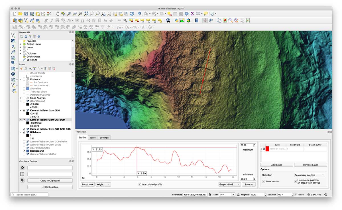
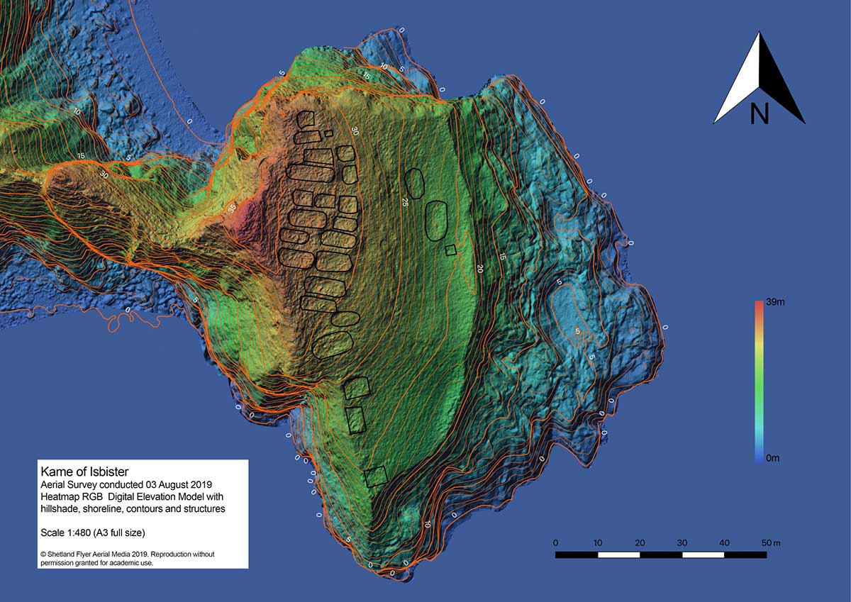
Despite the long grass, they managed to distinguish each structure out of the orthomosaic using the 32-bit floating point raster digital elevation model (DEM). The team created a basic map with structures and contours, a hillshade version and a heat map.
With proper preparation and setup, a GNSS RTK receiver with a drone can gather enough high-accuracy data to create accurate models and maps of an archaeological site — even if it’s hard to reach.