No audio available for this content.

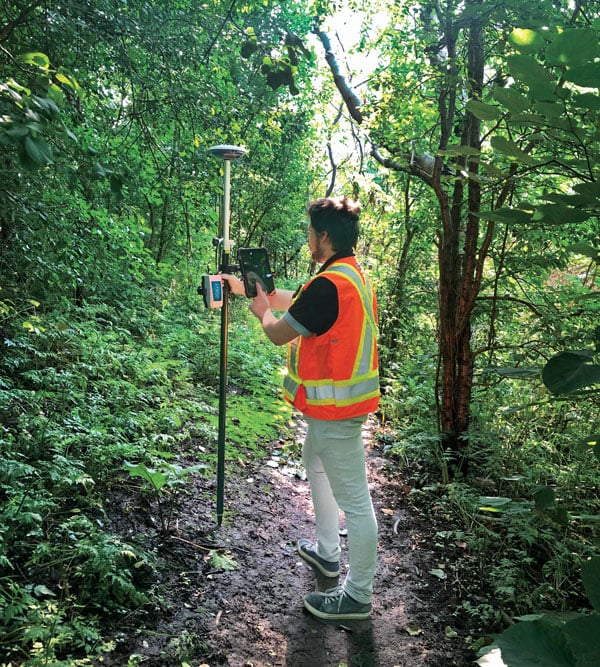
As most readers of this magazine know, GPS, like the other three GNSS, consists of three segments: the space segment — i.e., the satellites; the control segment — i.e., the monitoring and control stations on the ground around the world; and the user segment — i.e., the receivers. The first two are developed, operated and maintained by the U.S. Space Force, while the third one, for civilians, is totally in the hands of the private sector.
Most of the progress in receivers is evolutionary, with rare dramatic changes. To provide a snapshot of the current state of GNSS receivers, I asked several manufacturers three questions. What follows are short, etre dited excerpts of their answers that showcase the applications of GNSS receivers in a wide range of industries.
The participants in this cover story are:
- Eos Positioning Systems Inc. — Sarah Alban, Director of Marketing
- JAVAD GNSS — Simon Baksh, VP Product Development
- Hexagon’s autonomy & positioning division — Stephen Ching, Core Segment Manager
- Trimble — Karl Bradshaw, Market Manager, Mobile Mapping
- u-blox — Oreste Concepito, Head of Product Strategy Positioning
- Septentrio — François Freulon, Head of Product Management
- Hemisphere — Miles Ware, VP of Marketing
- Geneq — René Parisé, President
What is one of the most recent end-user applications for your receivers? What challenges does it pose and how do your receivers address them?
Sarah Alban (SA): Eos Positioning Systems is lucky to have innovative customers who span a variety of industries. In just these past few weeks, we’ve connected to customers who are using Arrow Series GNSS receivers to meet myriad business needs. Here are just a few examples: On the Caribbean island of Martinique, Odyssi uses an Arrow 100+ with RTK to get accurate water utility locations in a challenging environment. In Texas, midstream pipeline operator Kinetik and its GIS Manager Papillon Romero equip their field workers with an Arrow Gold to update the locations of previously unreliable legacy as-builts. In the Galápagos Islands, a researcher has been using the Arrow Gold+ and Galileo High Accuracy Service (HAS) to georeference drone imagery. In Colorado, GIS specialist Jim Casey uses an Arrow Gold to bring to life a Japanese internment camp in augmented reality.
Simon Baksh (SB): One of our customers is a leading construction contractor who uses our DELTA GNSS receiver for monitoring during deep crack grouting deformation to ensure that the natural state of the ground remains undisturbed during remedial work.
Stephen Ching (SC): One of the most exciting projects happening within Hexagon’s Autonomy & Positioning division is the automated road train platooning application within the mining industry. Transporting raw materials, iron ore in this case, has posed a huge challenge in terms of drivers’ safety, labor shortages and rising fuel costs. Our division is currently developing an autonomous hauling system that solves this challenge by integrating drive-by-wire, perception, positioning and path planning technologies. Our positioning system utilizes a PwrPak7D-E2 plus TerraStar-C PRO solution from Hexagon | NovAtel, which incorporates GNSS+INS technology and real-time kinematic (RTK) From the Sky technology.

Karl Bradshaw (KB): Traditional survey methods or tripod-based scanning on highways can be time-consuming and dangerous. Survey companies do not want to put surveyors in danger of traffic while traversing along a road. Mobile mapping allows them to safely, accurately and productively gather detailed point cloud and immersive imagery of highways without needing to put a surveyor in the field.
Oreste Concepito (OC): At u-blox, we have seen an increasing demand for GNSS receivers to be used for advanced driver-assistance systems (ADAS) applications and for mobile robotics (such as robotic lawnmowers). GNSS technology is adopted when an accurate, trustworthy position with high availability is required. In the autonomous operations domain, customers are constantly pushing u-blox to improve dependability while maintaining or ideally improving position accuracy, even in challenging environments.
François Freulon (FF): One of our most recent end-user applications is related to resilient timing for mission-critical infrastructure, including finance, data centers, energy and telecommunications. The relevant Septentrio product is the mosaic-T. The recent addition of the AtomiChron timing service further enhances its timing precision, GNSS resilience and anti-spoofing by offering navigation message authentication (NMA) on all for GNSS constellations. The first customer integrating this technology is Meinberg.
Miles Ware (MW): The Galileo High Accuracy Service (HAS) has created new interest in a traditional GNSS market, GIS and mapping, in which the availability of global 20 cm accuracy is turning many heads. While there are many technologies to improve accuracy for this market, few are appropriate. Often the work takes place in remote areas where cellular connectivity is not available for delivering corrections. They may also be in regions of the world where satellite-based augmentation systems (SBAS) are not available or able to meet performance expectations. Galileo HAS resolves both of these concerns. We now support it in our Phantom and Vega receivers.
In the past few years, we have seen the completion of two new GNSS constellations and a large increase in the options for corrections services. How has this impacted the design and/or features of your receivers?
SB: Our 874 channel TRIUMPH ASIC design has capacity for all constellations and signals to utilize current and future GNSS technologies. Additionally, our J-Star PPP Service using geostationary satellite broadcast for global delivery and cm level positioning extends operations to remote areas where networks are absent or where a base station setup and operation is not feasible.
SC: With BeiDou and Galileo in addition to GPS and GLONASS, there can be upward of 40 satellites in view — compared to 20 years ago when having 10 or 12 satellites in view was considered good availability. This gives much more choice as to which measurements contribute to a position solution, provided that the receiver can make measurements to all the satellites in view. Hexagon | NovAtel’s OEM7 was designed to support all GNSS constellations and frequencies, which required supporting many channels as well. The benefits of more satellites in the sky come under challenging conditions with many obstructions and strengthened positioning geometry in unobstructed conditions. In addition to more satellites, BeiDou and Galileo also introduced a new frequency at E6/B3, in addition to L1/L2/L5, which is particularly useful in global PPP solutions, such as RTK From the Sky and TerraStar C-PRO Correction Services.
KB: We have onboarded these constellations into our mobile mapping portfolio in the same way as all other Trimble GNSS portfolios, through rigorous, tried and tested methodologies.
FF: Septentrio receivers already support all GNSS constellations for high precision and resilient positioning. We have added Galileo E6 support and OSNMA, BeiDou phase III satellites (PRN>37) and other new signals (B3I, B2b) to our products through our latest firmware releases. We are also contributing to the large increase of corrections services by providing the backend core technology through our base station receivers or reference receivers. For example, the PolaRx5 reference receivers are used worldwide in many correction network infrastructures. With the support of all in view constellations and signals, Septentrio products are becoming part of critical infrastructure. Therefore, it is essential they have reliable continuous operation as well as security to protect them from potential jamming or spoofing attacks. Additionally, Septentrio has recently launched the Agnostic Corrections Partner Program to help customers find their way in the growing maze of correction offerings and to facilitate the integration of the right service into their system.
OC: Our customers are increasingly operating in a global market. To respond to that need, u-blox receivers support both the global and the regional constellations, such as Japan’s Quasi-Zenith Satellite System (QZSS) and India’s Indian Regional Navigation Satellite System (IRNSS, aka NavIC). The offer for correction services has also evolved to be able to serve the global market, moving toward uni-directional streams, possibly distributed via L-band. We support a complete portfolio of correction services, responding to all commercial and performance requirements, from the soon available, free-of-charge, lower accuracy correction services, up to the dm-level functional safety-certified correction services for autonomous driving.
MW: Since 2019, our core receiver technology has been intrinsically both multi-GNSS and multi-frequency by design. This allows our engineering team members to rapidly adapt to new and emerging solutions, and for Hemisphere to meet user and market demands. Hemisphere has also worked with our integrators to recognize the need to simplify the decision process around selecting receivers. While it is possible to configure our receivers to track specific constellations only, Phantom and Vega are being offered with multi-GNSS as standard. Similarly, clients can choose L1-only, or all-frequencies. This is why many integrators will quickly be able to take advantage of Galileo HAS.
RP: We have upgraded our SXblueGPS receivers with new GPS chips and with firmware updates to keep up with the new constellations available. Regarding the new correction services, the SXblueGPS have used and use by default the SBAS correction service and its associated networks throughout the planet to improve their precision. Where correction services via internet or SBAS do not exist, they use L-band correction services to have global coverage. In some cases, for topography base and mobile solutions, UHF links provide a customized correction service.
Are jamming and spoofing significant challenges in your key markets? If so, how do you address them?
SB: Yes, and AJ/AS expands on existing RAIM for assured position quality. Patented anti-jamming and anti-spoofing techniques identify and suppress GNSS interference, while maintaining navigation from good signals. Updated firmware for Navigation Message Authentication extends AJ/AS protection further.
SC: GNSS interference such as jamming and spoofing do present significant positioning challenges in many of our markets, especially defense, marine and autonomy applications in which safety and 24-7 operation are paramount. How often GNSS interference happens (and is detected) and how seriously it affects the application depends on the market. It is a threat that can be mitigated by well-designed user equipment. Hexagon | NovAtel has developed a comprehensive GNSS resiliency portfolio to assure that our users’ position is protected with our interference mitigation technology, starting from the GAJT antennas all the way down to the receiver level. NovAtel’s OEM7 receivers include our GNSS Resilience and Integrity Technology (GRIT) firmware options, which provides spoofing detection, interference detection, and mitigation with digital filters, as well as time-tagged digitized samples for advanced situational awareness.
KB: As it applies to mobile mapping with the Trimble MX50, jamming and spoofing are not significant challenges.
OC: A team of engineers is constantly improving our anti-jamming and anti-spoofing technology. U-blox customers are today more mindful of the risks associated with GNSS interference, both intentional and unintentional. GNSS is adopted in critical infrastructures and autonomous vehicles, where jamming and spoofing could lead to severe consequences. While no system can be safe in absolute terms, increasing the sources of information can greatly improve the resilience against jamming and spoofing attacks. Multi-constellation GNSS receivers, multi-band constellations, inertial sensors and accelerometers, can all be individually used as additional safety layers contributing to a more robust solution. Additional measurements are implemented at the positioning engine level, as part of our functional safety program. The availability of authenticated signals, being introduced by Galileo’s Open Service – Navigation Message Authentication (OS-NMA), will also contribute to increasing the GNSS robustness against interference.

FF: Definitely, and we are seeing a large increase in demand for resilience in many applications and for assured positioning, navigation and timing (PNT). Providing trustworthy information is critical now for many markets, such as machine control, robotics, timing, infrastructure and assured PNT. Our multi-frequency multi-constellation GNSS technology not only maximizes accuracy and availability in areas where the sky is partially obstructed, but also provides extra resilience against jamming and spoofing. All our GNSS receivers are resilient to jamming and spoofing thanks to the built-in Advanced Interference Mitigation (AIM+) technology, which suppresses the widest variety of interferers, from simple continuous narrow-band signals to the most complex wideband and pulsed transmissions.
MW: Fortunately, jamming and spoofing are not common occurrences in most of our markets. However, their nature is such that they can appear at any time, in any place, without warning. This can cause otherwise routine plans for users to suddenly grind to a halt. Hemisphere’s Cygnus interference solution provides protection against up to 60 dB of jamming and is built into our current generation products by default. Having Cygnus available can make the difference between working normally and searching for alternate solutions. A welcome tool offered through Galileo satellites is OS-NMA signal verification, which provides excellent protection against spoofing attacks. Firmware updates provide our current product platforms access to OS-NMA spoofing protection. As our standard products are already activated for multi-constellation operation, it simplifies integration for our users.
RP: Interference is inevitable given the enormous number of signals from telephone and electrical networks, among others, as well as buildings, trees and, of course, the weather. To mitigate this, we use multi-frequency and multi-GNSS antennas that allow us to obtain the best reception in areas of interference. Additionally, we have state-of-the-art GPS chips that block and purify signals that generate distortion. On the other hand, there is interference by intentional GNSS falsifications or by radio amateurs who transmit radio signals for drones and other devices that cause GPS signal loss, which are mitigated by the latest technology algorithms of our SXblueGPS.


