No audio available for this content.
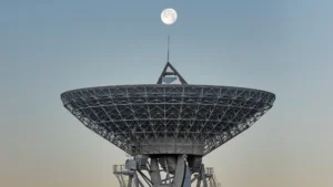
The European Space Agency has issued an intriguing Intended Invitation To Tender, “Weak GNSS Signal Navigation on the Moon.” The study will investigate use of weak-signal GPS/GNSS — and of course ESA is interested primarily in the use of Galileo — for real-time position, navigation and timing information to various future lunar assets such as automated landers, rovers, Earth-Moon transportation vehicle, in-situ navigation, and so on.
Does ESA have a lunar exploration agenda? This I did not know, but with only my own ignorance to thank, I quickly found out that ESA has had a lunar orbiter, SMART-1 (Small Missions for Advanced Research in Technology), since 2004, equipped with an Advanced Moon Imaging Experiment (AMIE) micro-camera and a mission, at least in part, to zero-in on suitable study sites for potential future lunar exploration missions.
Since the conclusion of that project, ESA now plans to land a spacecraft in 2018 near the Moon’s south pole, a region full of dangerous boulders and high ridges. The aim is to probe the moonscape and test new technology — and now we know this includes GNSS — to prepare for future human landings. “The region may be a prime location for future human explorers because it offers almost continuous sunlight for power and potential access to vital resources such as water-ice.”
“Although the visibility geometry is not always favorable,” the current ESA Invitation to Tender states, “it would result in 100-500m position accuracy as estimated in a NASA JPL/Ohio University paper. For lunar navigation applications, GPS/Galileo signals could be used if receivers complemented with advanced processing signal and filtering techniques, are capable of acquisition and tracking in the order of 15dBHz signal to noise ratios. Today latest developments show that these values are feasible. The PNT performance figures could also be improved with a GNSS-based system on a lunar relay satellite orbiting the moon as analyzed in [RD3]. The hardware required is equivalent to GPS space-based receivers and a high gain antenna.”
The invitation to tender, to the tune of 200,000–500,000 euros, closes on April 23.
GNSS use in space exploration, novel as it seems, has been outlined and partially explored in previously published articles in GPS World.
In September 2008, Jim Miller and A.J. Oria brought us all up to date on the U.S. National Aeronautics and Space Administration’s (NASA’s) plans to use GPS in the great dark out-there.
“NASA has engaged with the Department of Defense (DoD) to define the performance parameters to support navigation services in a Space Service Volume (SSV) designated from 3,000 kilometers to GEO altitude to approximately 36,000 kilometers,” they wrote in “NASA’s Vision for Space.”
“This type of navigation requires specialized software to process the side-lobes of GPS signals coming over the earth’s limb, as well as the increased attenuation and tracking of a very few satellites at a time. Once tracking is initiated. however, one can begin to imagine a future where GPS-in-space may also include syncing GPS positioning and timing with spacecraft and beacons broadcasting other “GPS-like” signals near celestial bodies such as the moon and Mars.
“Transition from terrestrial-based radar tracking of space vehicles to space-based radiometric data from GPS is well underway at NASA. Simulations demonstrate GPS Navigator receiver applications could be performed almost to the moon. An ongoing effort is developing the TDRSS Augmentation Service for Satellites (TASS) to disseminate differential corrections from the Global Differential GPS (GDGPS) network to users in LEO. The Communication, Navigation, Networking, reConfigurable Testbed (CoNNeCT) on the ISS will use software-defined radios to process GPS/GNSS signals and waveforms.’
Also, in “GPS Goes Martian: Nav/Com for a Red Planet,” a 2004 article by Susan Skone, Kyle O’Keefe, and Gerard Lachapelle, the authors describe plans for a network of satellites to be placed in orbit around our eerie solar-system sibling for the purpose of GPS-like navigation.
Finally, way back in 2002, a group of authors proposed “Formation Flight in Space.” Russell Carpenter, Michael Moreau, Jonathan How, Lesse Leitner, Frank Bauer and David Folta described how distributed spacecraft systems are developing new GPS capabilities, on the drawing boards, at least.
“Scientists have just begun to understand the full potential of space vehicle formation flying. In the last few years, this technology has gone from a space oddity — and a high risk one at that — to a concept fully embraced by earth and space scientists around the world. Prior to the selection of the New Millennium Program Earth Orbiter-1 (EO-1) mission in 1996 (the first autonomous formation flying earth science mission), the National Aeronautics and Space Administration (NASA) had only one or two formation flying concepts under consideration. Now 35 mission sets fill that list.”
If any young and adventurous engineers out there have been lamenting the dearth of new frontiers for them to explore GNSSively, cry no more.