Listen to this content
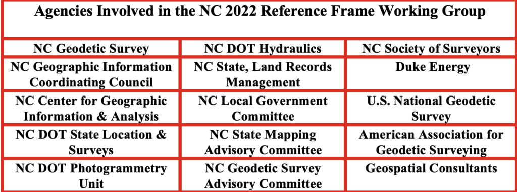
In my October 2025 GPS World Newsletter, I highlighted professional societies forming working groups for the new NSRS — the National Society of Surveyors (NSPS), the American Society of Photogrammetry and Remote Sensing (ASPRS), and the American Association for Geodetic Surveyor (AAGS). Under Gary Thompson’s leadership, the North Carolina Geodetic Survey also established the North Carolina 2022 Reference Frame Working Group (NC RFWG), which includes representatives from NC agencies that produce or use geospatial products and services. This newsletter spotlights several NC RFWG activities to inform and assist other agencies and working groups.
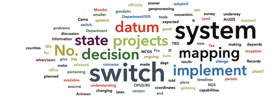
As noted in my previous newsletter, NC RFWG agencies are proactively conducting self-assessments of their needs and processes to identify challenges and opportunities early, enabling a smooth transition and sustained operational efficiency. The working group meets monthly to review progress on activities.
One key task of the working group was to develop a short online questionnaire. The goal was to open a dialogue with geospatial professionals and better understand their readiness for the upcoming modernization of the National Spatial Reference System (NSRS).
The questionnaire was designed to address the following key questions:
- Are you prepared to implement the new NSRS once the National Geodetic Survey (NGS) officially adopts it?
- Do you have the necessary tools and resources in place to ensure a smooth transition?
- Has your organization established a timeline for transitioning to the modernized NSRS?
- What concerns do you have regarding the transition to the new NSRS?
The section titled “Introduction of North Carolina Questionnaire” explains the purpose and background of the survey, while the section titled “North Carolina Online Questions” presents the list of questions included in the questionnaire.
Introduction of the North Carolina Questionnaire
This questionnaire seeks stakeholder input on the upcoming modernization of the National Spatial Reference System (NSRS). Your feedback is welcome on the proposed questions, as well as any concerns about the datum transition, tools (such as updated NCAT, OPUS, and SPCS2022), data transformation strategies, workflow impacts, and preparation needs.
The National Geodetic Survey (NGS) is replacing the North American Datum of 1983 and the North American Vertical Datum of 1988 with new plate-fixed terrestrial reference frames (NATRF2022, PATRF2022, CATRF2022, and MATRF2022) tied to the International Terrestrial Reference Frame 2020, along with the new vertical datum, the North American-Pacific Geopotential Datum of 2022.
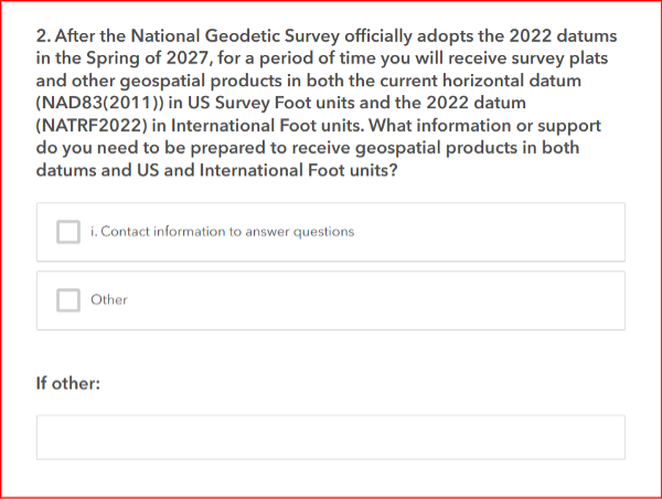
In spring 2027, new horizontal and vertical datums will be implemented:
Horizontal
- North American Terrestrial Reference Frame (NATRF2022)
- Replaces the North American Datum of 1983 (2011)
Vertical
- North American-Pacific Geopotential Datum of 2022 (NAPGD2022)
- Replaces North American Vertical Datum of 1988
Units
- 14B NCAC 03 .0602 REQUIRED FOOT CONVERSION
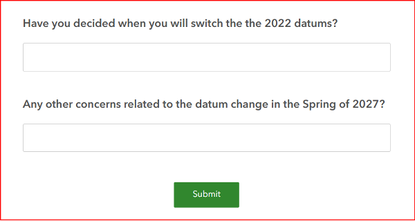
North Carolina Online Questions
The section titled “Results of North Carolina Online Questionnaire” summarizes the survey responses collected as of April 27, 2026.
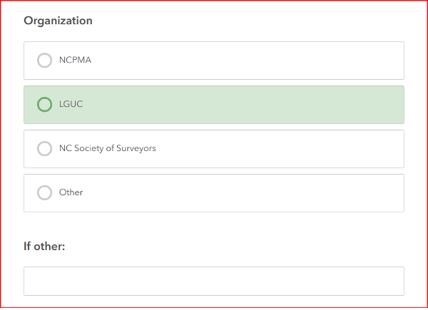
[Note: NCPMA refers to the North Carolina Property Mappers Association, and LGUC refers to the North Carolina Local Government Committee.]
Results of the North Carolina Online Questionnaire
(April 27, 2026)
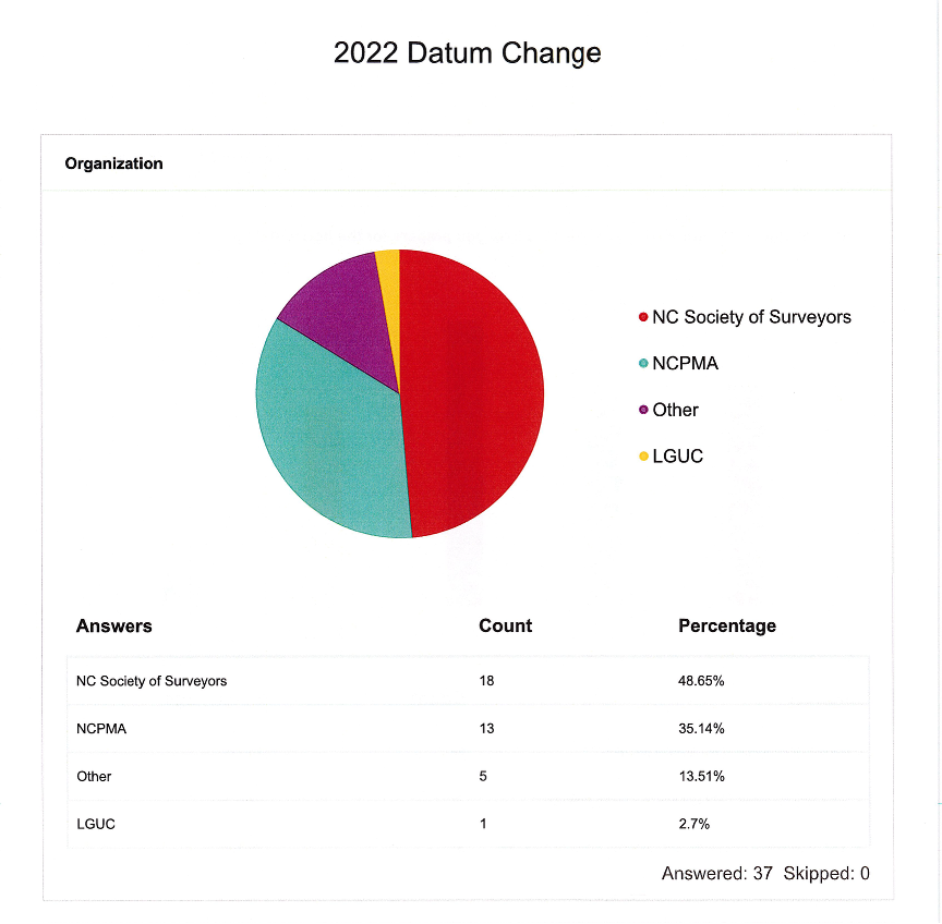
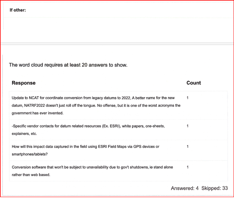
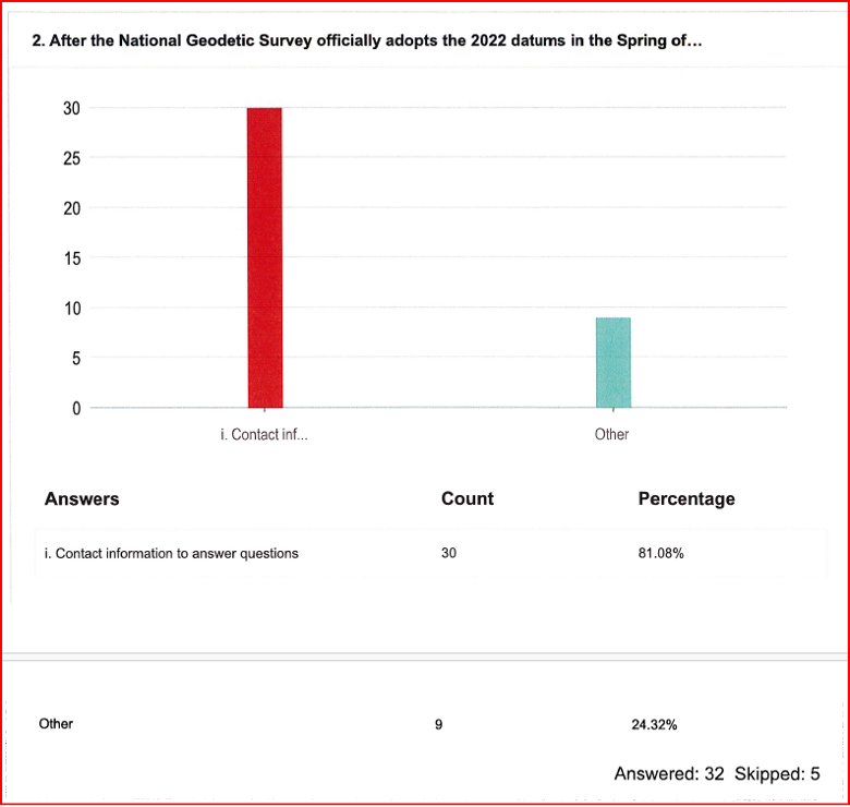
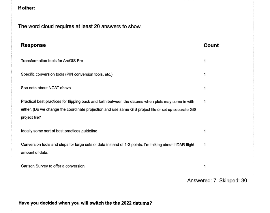
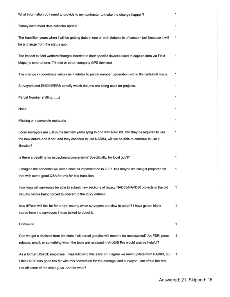
This questionnaire solicited input from the North Carolina Property Mappers Association (NC PMA), the North Carolina Geographic Information Coordinating Council (GICC), and the North Carolina Local Government Committee (LGC). Although focused on North Carolina, the results may benefit other working groups. The NC working group is reviewing all feedback—especially regarding the Spring 2027 datum change—and will develop materials to address it.
In addition to the questionnaire, the working group prepared a short guidance document on the new reference frames for local governments and state agencies. It outlines how to prepare for the 2027 datum change and covers:
- Preliminary steps for transitioning when NGS and North Carolina officially adopt the new datums in 2027.
- Actions users can take now to ready NSRS‑referenced data for the modernized NSRS and the shift from U.S. Survey Foot/International Foot.
- Estimated coordinate changes with the 2027 adoption of:
- North American Terrestrial Reference Frame (NATRF2022)
- North American-Pacific Geopotential Datum of 2022 (NAPGD2022)
- New national geoid model (Geoid2022)
- North Carolina State Plane Coordinate System of 2022 (SPCS2022)
- Current NC statewide digital orthoimagery acquisition cycle and statewide lidar collection schedule.
- How the NC CORS and Real-Time Network (RTN) will support the modernized NSRS.
- Web links to more detailed resources.
The working group is developing a case study on preparing a FEMA Elevation Certificate using the modernized NSRS (NATRF2022 and NAPGD2022). It will be featured in upcoming newsletters. The North Carolina Geodetic Survey will host the materials on its website, and I’ll share the public link once it’s available.


