Listen to this content
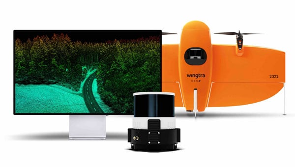
Wingtra, a UAV technology company, has introduced a lidar UAV mapping solution that combines the WingtraOne GEN II UAV with a newly developed lidar sensor. This integration aims to advance UAV lidar efficiency, increase accuracy and simplify integration.
The lidar solution incorporates a Hesai scanner, Inertial Labs IMU and NovAtel GNSS designed to optimize data acquisition and reduce the need for post-processing strip alignment. This advancement offers immediate access to precise terrain information following each flight and enhances the efficiency of mapping and photogrammetric analysis in various sectors.
One of the key features of the lidar system is its reduced field time, with no calibration needed and a one-minute initialization process. The Wingtra lidar application and the system’s automated features offer a streamlined data capture process, which makes it accessible even to those new to lidar technology.
Carlos Femmer, director of data acquisition at HDR, tested the Wingtra lidar payload and noted its ability to produce high-quality data on both vegetated and non-vegetated surfaces with minimal noise compared to other sensors in the same price range.
The solution offers a vertical accuracy of 3 cm from a 60 m flight height, with leading point density in its class. The WingtraOne GEN II’s design and automated flight patterns offer consistent results across different pilots.


