
New version of OxTS Georeferencer provides more lidar integration
June 21, 2021
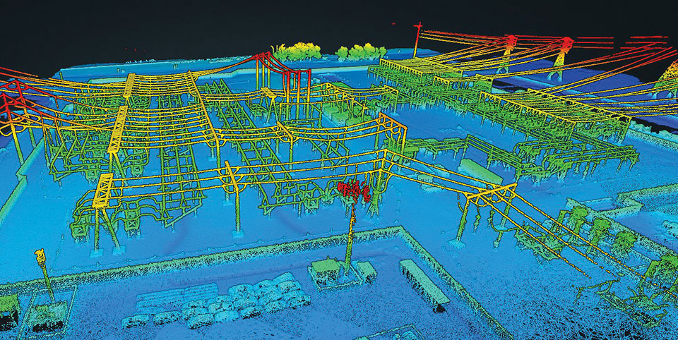
Oxford Technical Solutions (OxTS) has launched the latest version of its lidar georeferencing software, OxTS Georeferencer 1.4. OxTS […]
Read More
Oxford Technical Solutions (OxTS) has launched the latest version of its lidar georeferencing software, OxTS Georeferencer 1.4. OxTS […]

Of the hundreds of papers researchers presented at the Institute of Navigation’s annual ION GNSS+ conference, which took […]

The High-BIAS2 project advances cold-atom quantum gyroscope The High-BIAS2 (high-bandwidth inertial atom source) project today announced new milestones […]
Lidar and photogrammetry payload maker Rock Robotic has finished development of its new Rock R2A payload. Featuring the […]

For the past decade, widespread deployment of autonomous vehicles (AV) has been just over the horizon — that […]

Inertial navigation systems (INS), like most navigation systems, have evolved through countless iterations and improvements over many years. […]

OxTS is offering its new OxTS Georeferencer, a powerful lidar georeferencing software tool. OxTS Georeferencer combines OxTS inertial […]
Getting the Best in Both WorldsGPS alone won’t cut it. Thankfully, other navigation sensors can be used to supplement or replace GNSS when the going gets tough for GPS alone.


Follow Us