No audio available for this content.
Last summer at the Space and Missile Defense Symposium, GEO Huntsville held its annual GEOINT workshop including a keynote by NGA (National Geospatial-intelligence Agency) Deputy Director Sue Gordon. One of the sessions, presented by Mike Botts, focused on the OpenSensorHub and related information published on GitHub.
His topic: clearing the path for use of geospatial-capable devices via the Internet, thus preventing a geospatial Tower of Babel.
In the mid-80s, I purchased my first personal computer from Sharper Image, a 286 with a monochrome monitor. The PC was not bad for its time, and I learned a lot about personal computing, but hooking up a dot-matrix printer at the time was a nightmare. There were numerous types of printer cables — 25-pin parallel, 36-pin Centronics, 15-pin, etc. Additionally, some printers needed changes to the pin configurations, so nothing about the process was easy.
Then, after the mechanical connections were made, proper drivers had to be loaded, not to mention operating system and software configuration. Today, you simply plug in a USB cable or go wireless and are off and running thanks to “plug and play.” However, plug and play is only common in popular mass-market devices such as printers, scanners and cameras. Most other devices, even commercial consumer devices, can still present maddening connection challenges.
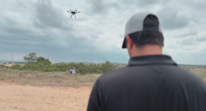
One example: About five months ago, I tested more than a dozen different Internet video security cameras for a special project. All the cameras I tested touted quick and easy connection. Some were quite nice, while others were installation torture — I returned those after a few days.
One well-known consumer brand was especially bad. I spent more than three hours with hard-to-understand tech support in India, and after countless different IP configurations and tests, I gave up. I decided that my remaining life is too short to waste that much time on a poorly designed camera system.
(By the way, the FLIR FX and Netgear Arlo were my top choices. Both connected fast and easy, both have especially nice cloud applications and both are wireless, including power. The FLIR is rechargeable, but the battery life of the Arlo seems remarkable, although some reviewers differ, especially outdoors and in freezing weather. In my test, after three months of flawless operation indoors, the Arlo is still on the original set of batteries at 60 percent, so it gets my top nod.)
OpenSensorHub
What is OpenSensorHub, and what are they doing to help achieve universal plug and play? By their own definition:
“OpenSensorHub is a license free, open source software platform for geospatial (FOSS4G) sensors that allows you to easily, rapidly and affordably network sensors into a seamless SensorWeb of real-time, location-aware, interoperable, web accessible services. With OpenSensorHub, these OGC compliant SensorWebs can be enabled across all manner of space-based, airborne, mobile, in situ and terrestrial remote sensors — including your basic mobile device. OpenSensorHub finally makes it possible to integrate location-aware sensors into the geospatial mainstream.”
(FOSS4G — Free and Open Source Software for Geospatial — is an annual recurring global event hosted by OSGeo growing out of the GRASS and MapServer communities. OSGeo — Open Source Geospatial Foundation — promotes open source software and resources. OGC — Open Geospatial Consortium — promotes open geospatial standards for both open source and proprietary software.)
The OpenSensorHub evolved from the early work of Mike Botts of Botts Innovative Research and Alex Robin of Sensia Software for NASA. They very laboriously designed and developed systems and software to connect sensors and actuators into an interoperable and integrated environment. They also realized that this connectivity and integration process had to become streamlined and not a custom programming effort every time for every device. Thus was born the idea of Sensor Model Language (SensorML) and, thanks to NASA funding in 1999, it became a reality.
Over the years, many scientists and engineers worked to develop connectivity for devices that could be queried and controlled through the Internet, called the Internet of Things (IoT). However, a key missing element of IoT was location awareness, so in 2000, SensorML was brought to the Open Geospatial Consortium (OGC) and served as a catalyst for the creation of a suite of open standards to support location-enabled discovery, access and tasking of sensors through web services and XML encodings. They named it the OGC Sensor Web Enablement (SWE) standards, or SWE for short.
The SWE standards, now in version 2.0, have been adopted worldwide supporting scientists, emergency responders and the military. Although SWE opened the door to geospatial integration, much work still remains to achieve true plug-and-play connectivity of thousands of devices. In my mind, SWE is standardizing communication protocols between sensor and actuator devices, much like USB standardized interactions between disparate devices.
However, what really enables us to plug in a USB cable and have instant and effortless communication between various devices, is the software and hardware that implement the USB standard protocols. This, in essence, is the focus of the OpenSensorHub community, to provide open software and hardware that fully implement the SWE vision and enable us to have effortless interaction between IoT devices.
This is also where the OpenSensorHub community needs your help. In addition to helping improve the significant capabilities of the OpenSensorHub Core, the OpenSensorHub community is looking for those interested in deploying sensors and in developing adaptors and adaptor technologies for adding new sensors, actuators, and processes.
If you’d like to learn more about the technology and ways that you can contribute, check out the OpenSensorHub website or contact the team at info@opensensorhub.org.
Other useful links include demo videos and source code.