No audio available for this content.
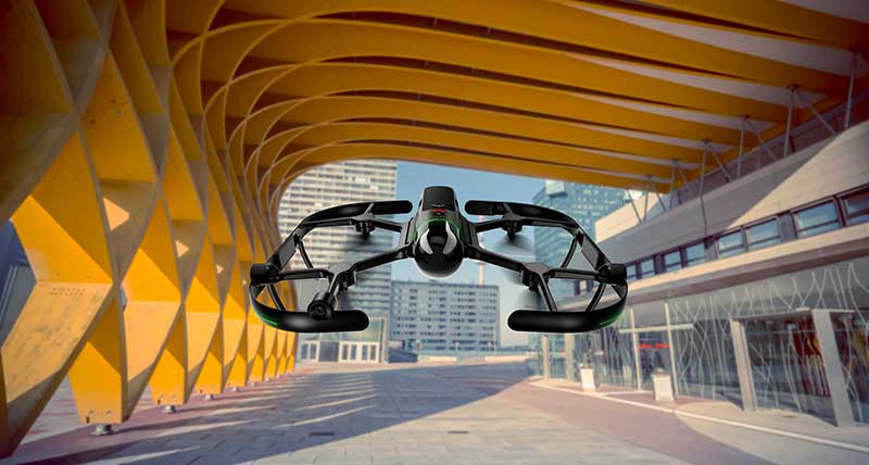
Leica Geosystems, part of Hexagon, has added new capabilities to the Leica BLK2FLY. It now has the ability to scan indoors, providing expanded coverage for complex scanning projects, and the ability to create digital twins for entire structures, both indoors and outdoors.
Hexagon upgraded the autonomous UAV scanning system to allow for safe, effective indoor navigation and capturing. This capability also expands the BLK2FLY’s ability to capture various environments outdoors.
The UAV can scan in areas without GNSS availability, opening reality capture opportunities in new settings, including hazardous indoor areas such as nuclear power plants. Increased performance of the autonomous navigation system heightens the sensor’s spatial awareness, allowing for obstacle avoidance in more confined spaces. This new capability relies upon advancements to Hexagon’s visual SLAM system, providing real-time spherical imaging that improves the BLK2FLY’s operating range to a radius of 1.5 meters.
The BLK2FLY complements Hexagon’s terrestrial and autonomous sensor. Users can also use Reality Cloud Studio, powered by HxDR, Hexagon’s cloud application that enables uploading of data to the cloud from the field using a tablet or smartphone to register, mesh and create 3D models of their data from the field automatically.
The technology’s new indoor scanning capabilities are available at no extra cost via firmware update to all current and future BLK2FLY users.


