
No audio available for this content.
As technology evolves, the Civil Air Patrol will continue to be a platform for implementing new technologies to secure the country in times of crisis.
| The strength of this country isn’t in buildings of brick and steel. It’s in the hearts of those who have sworn to fight for its freedom! —Captain America |

If you are someone who likes aviation, GIS and emerging technologies like artificial intelligence and computer vision, and you want to fulfill a greater sense of purpose, the perfect time is now.
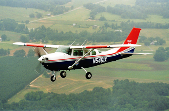
The Flying Minute Men, so called by Robert Neprud in the 1948 Story of the Civil Air Patrol (CAP), serve on the frontlines of national threats and disasters. They are the air wing for first responders.
CAP works with many government organizations including the Federal Emergency Management Administration (FEMA), The National Geospatial-Intelligence Agency (NGA), the National Oceanic Atmospheric Administration (NOAA), the Army Corps of Engineers, the National Guard, and many others.
CAP works with non-government organizations too, such as the United States Geospatial Intelligence Foundation (USGIF), the GIS Corps, the National Alliance for Public Safety GIS (NAPSG), and the Red Cross.
CAP also works with youth teaching valuable skills in leadership, community service, STEM and aviation. It has a proud heritage originating in World War II.![]()
In the final days of 1941, the world was in flames. Dark shadows lurked in the waters off American shores. German U-boats attacked ships along the coast. The newly established Office of Civilian Defense understood the importance of aviation for stopping the U-boat threat but lacked the military resources. On Monday, December 1, 1941, six days before the attack on Pearl Harbor, Administrative Order 9 was signed creating the Civil Air Patrol, but there would be no celebration. The threat was all too real. The Battle of the Atlantic had begun. Within a few months Germany sank over 230 ships in U.S. waters. American shores were on fire.
A list of known shipwrecks and their locations in U.S. waters can be downloaded from NOAA’s Coastal Survey website. It is not a complete or a clean dataset so some wrangling will be required. A shortcut is using the shipwreck layer in Google Earth. Along the Atlantic Coast, Gulf of Mexico, and Caribbean Sea there are multiple sunken German U-boats. Most notably are U-85, the first U-Boat sunk by the U.S. Navy in WWII, less than 20 miles off of Nag’s Head, North Carolina (35.885, -75.2829); and U-853, the last one to be sunk in WWII 10 miles off the coast of Rhode Island less than 24 hours before Germany’s surrender (41.2268, -71.4187).

During the War, the Civil Air Patrol flew 5,684 aerial escorts for shipping convoys keeping the sea lanes safe and enabling supplies to get to Europe and North Africa. Shortly after the war, on July 1, 1946, President Truman recognized the valuable contribution made by the Civil Air Patrol making them permanent, but once again there was no celebration. On the same day, responding to overwhelming public attention, TIME published “COSMOCLAST EINSTEIN: All matter is speed and flame.” Radios around the world tuned-in as the clock counted down to zero hour. The first post-war atomic bomb was detonated at 22:00 Greenwich Mean Time (5:00 PM Eastern) in Bikini Lagoon (11°36’00” N 165°29’00” E) over a ghost fleet of ninety-five ships in the middle of the Pacific. History’s long shadow fell over the moment. The applause of a grateful nation for the Flying Minute Men was silence.
It is the mark of real heroes, duty is the highest honor, the rewards are personal having the courage to stand in the face of danger and clasp the hand of Victory. It is valor not fame that makes heroes of normal men and women. The Civil Air Patrol rarely makes the front page, but it supports many of the nation’s most significant events.

The first photographs of Ground Zero released to the public the day after September 11, 2001, were taken by the Civil Air Patrol. With the creation of the Department of Homeland Security in 2002 the Civil Air Patrol took on a much larger role in homeland security. CAP serves a unique purpose flying a multitude of missions because aircraft can fly for extended periods at optimum altitudes to get the best resolution. CAP imagery is often the most currently available and of the highest quality after an event. The Civil Air Patrol aircraft can carry interchangeable sensor arrays, such as thermal cameras, synthetic aperture radars, lidar, communications equipment, and more. Imagery collected by the Civil Air Patrol is publicly available on the CAP GIS Portal.
In 2017, FEMA hosted a Disaster Crowdsourcing Exchange laying a foundation for working with the Civil Air Patrol to push the imagery out to various crowdsourcing channels. The Red Cross Humanitarian OpenStreetMaps Team (HOT) used it to map road networks. Crowdsourced imagery analysts used it for feature extraction and damage assessments. In 2018, this effort was developed further using Hurricane Michael imagery of Panama City, Florida, for creating artificial intelligence algorithms to identify and extract features.
The Civil Air Patrol captures imagery with the WaldoAir XCAM Ultra 50 by flying in overlapping circles as the aircraft sweeps over a disaster area. The overlapping images allow the system to create high-resolution 3D point clouds. The spatial intelligence algorithms employed with post flight processing conducted by Skyline and GeoX can automate feature extraction of buildings, vehicles, bridges, roads, cell towers, and other structures, and identify structures as destroyed, damaged, or undamaged. The system can begin damage assessments almost immediately. The process used to take several weeks with an enormous cadre of specialists and resources and now it can finish in a few days or less with a handful of specialized staff.
I had the privilege of speaking with the Director of Operations for the Civil Air Patrol, Mr. John Desmarais, or Moose as his friends know him. He is a 33-year veteran of CAP, has a pilot’s license, a master’s degree from Embry-Riddle Aeronautical University and is married with two children. Moose shared how September 11th, 2001 changed his commitment and understanding of C.A.P.’s role working with and supporting homeland security missions. He shared with me some of the stories above and gave me an in-depth look into CAP’s future.

Today, the Civil Air Patrol supports important missions. For FEMA CAP does post-event damage assessments after hurricanes, floods, tornadoes, fires, earthquakes, dam bursts, and more. This will be able to get people the assistance they need much faster ultimately saving lives. This year alone, the Civil Air Patrol has saved 91 lives according to the Air Force Rescue Coordination Center. Other examples are providing search & rescue, border protection, homeland security, emergency flight services, remote sensing, humanitarian support, education and training, and Air Force training support to name a few. These initial successes led Christopher Vaughan, the Geographic Information Officer of FEMA, to request the Civil Air Patrol provide GIS support for natural disaster operations. CAP remains very active fulfilling that commitment. Mr. Desmarais said that CAP took close to half a million pictures for the 2018 hurricane season. FEMA hosts all of CAP’s publicly available imagery as part of its GEOPlatform.
GIS has always been a huge part of what the Civil Air Patrol does when looking at it from a basic level of identifying locations, features, and information. Now, GIS is becoming central to the operations of the Civil Air Patrol because it is a force multiplier as in the example above, using spatial intelligence for completing disaster estimates in days instead of weeks with a fraction of the staff. This is powerful and driving the future of CAP towards a more geocentric operation. CAP’s GIS future is in modeling, remote sensing, crowdsourcing, artificial spatial intelligence, and data sharing.
In 2019, the Civil Air Patrol proposed its path forward creating opportunities for its members to gain valuable GIS skills and creating a qualification in GIS Operations. The Civil Air Patrol has recently begun fielding courses with support from its partners to provide training qualifications. Members of CAP can receive the following training courses: GIS for Emergency Managers, GIS Applications for Emergency Management, GIS Specialist and training in HAZUS, a GIS-based hazard analysis tool. This requirement for operations to become geocentric is so great that a call went out for people who are doing GIS work to reach out to the Civil Air Patrol Wing in their local area and consider joining. To find out more get in touch with your local Wing, visit www.GoCivilAirPatrol.com and enter your zip code to find a CAP squadron near you or you can reach out to the CAP National GIS team at GIS@cap.gov for more information. The Civil Air Patrol is using GIS more every day for search and rescue operations where CAP members are locating aircraft crash sites using ADS-B and radar data, and locating missing persons using cell phone forensics, and creating situational awareness maps for tracking resources and planning purposes for CAP senior leaders.
The Civil Air Patrol is investing into autonomous aircraft technologies. It has the largest inventory of small unmanned aerial systems (sUAS) for civilian/ public safety use in the nation. The great advantages to CAP for sUAS are their low costs to deploy and their ability to collect close-up, high-resolutions imagery with minimal risk to people. In disaster areas flying low level flights are extremely hazardous to piloted aircraft because wires and cables and other smaller objects that have shifted. The use of sUAS will fly alongside emergency responders and CAP expects to have sUAS available for each of its 150 incident command posts across the country by the end of 2020 with over 1,000 trained operators nationwide.
In the future, the high-resolution 3D imagery point clouds will enable the Civil Air Patrol to provide real-time virtual environments and augmented reality enhanced awareness for humanitarian assistance and disaster relief operations, especially when that imagery is infused with powerful geographic information systems and artificial spatial intelligence algorithms.
In the near term, the Civil Air Patrol will be expanding the number of aircraft it has equipped with FLIR and other high-end sensors and will continue growing its sUAS operations. It will continue its outreach efforts to build working relationships with new partners and bring onboard volunteers interested in supporting GIS and imagery analysis.
As technology evolves, the Civil Air Patrol will continue to be a platform for implementing new technologies to secure the country in times of crisis. The words spoken by Colonel Scott at the First Report to Congress in May 1948 continue to ring true.
| “I predict that the Civil Air Patrol will grow immeasurably stronger — it will continue to contribute to the strength and the security of this nation.” —Colonel Scott, First Report to Congress, May 1948 |


