Listen to this content
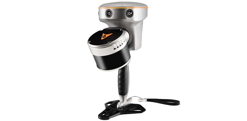
CHC Navigation (CHCNAV) has released the RS10 handheld SLAM lidar laser scanner integrated with a full real-time kinematics (RTK) GNSS receiver. Designed to improve efficiency across a wide range of mapping and surveying applications, the RS10 seeks to provide professionals with a versatile, all-in-one tool for capturing 3D geospatial data in both outdoor and indoor environments.
The device integrates a GNSS smart antenna for RTK positioning accuracy even in challenging environments. It delivers 5 cm measurement accuracy by fusing high-precision lidar, RTK, laser and visual SLAM using three HD cameras. It uses a powerful onboard processor for real-time georeferenced point cloud generation in the field. Users can receive instant feedback, which allows them to adjust while scanning. Large sites up to 13,000 square meters can be mapped in real time.
The integration of high-precision GNSS and SLAM technologies eliminates the need for traditional loop closure, which often complicates the data collection process for handheld scanners. Users can freely scan target areas without having to return to previous locations, which can streamline field data capture and significantly reduce time spent in the field.


