No audio available for this content.
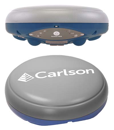
Carlson Software has introduced a new four-constellation, three-frequency surveying receiver. The Carlson NR3 network rover weighs just under two pounds, but delivers highly reliable GNSS real-time kinematic (RTK) for land surveying, geospatial information systems (GIS) and other data-collection uses.
Carlson Software President and Founder Bruce Carlson introduced the Carlson NR3 network rover at the company’s Grow With Us User Conference 2019.
Able to be used as a base or rover, the NR3 uses all four constellations — GPS, GLONASS, BeiDou and Galileo — and provides triple-frequency tracking on GPS, GlONASS and Galileo, the company said.
Incorporating multipath and ionospheric detection, the NR3 maintains accuracy and continued operation despite shocks, vibration or other interference.
According to the company, the NR3 is easy to mount and balance as it utilizes the optional Hybrid+ in Carlson SurvCE/PC that enables simultaneous interaction with GNSS and a robotic total station, the company said.
”The NR3 is Carlson’s answer for a lightweight – just 1.8 lbs. – network rover that can also be used in a base rover setup with Carlson’s Listen-Listen service,” said Butch Herter, Carlson’s director of Hardware Development. The Listen-Listen service allows base/rover operations via cellular modem for better correction transmission ranges compared to traditional terrestrial UHF radios.
“It has hot swappable batteries and four come with the system that give it over a 20-hour runtime,” Herter added. “With the dual internal cell modem antennas, it maintains cell signal where others may not. When paired up with the Carlson CR2+ robot, it is the ideal companion receiver to use with the new SurvCE hybrid surveying system.”
Produced by Septentrio with Carlson specifications, the Carlson NR3 has an integrated 4G LTE cellular modem, plus Wi-Fi and Bluetooth for modern wireless capabilities and is made to perform exceptionally in locations with bad visibility or interference.