No audio available for this content.
The ability to capture and evaluate truth on the ground through aerial imagery is an ever-growing industry, thanks to the proliferation of UAVs and access to imagery on demand and online. Yet obstacles remain that could prevent organizations from capturing location intelligence.
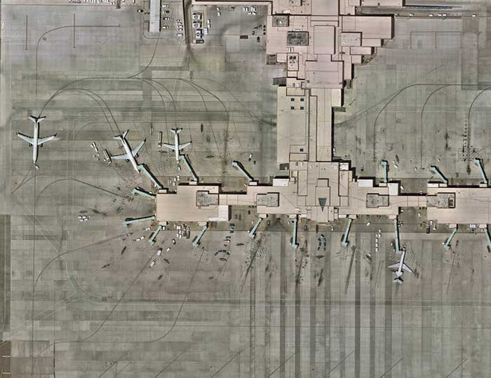
For organizations that require timely, accurate and current aerial imagery, an additional capture program outside of drones could be necessary. One company, Nearmap, flies fixed-wing aircraft two to three times per year over 430 urban areas across the United States. Using proprietary camera technology, Nearmap captures aerial data in a variety of formats: vertical, oblique and 3D. The location content is then delivered to customers via a web browser application and can be easily integrated into GIS/CAD applications.
A mid-size tech company in New Mexico using a drone to capture digital surface model data ran into two obstacles: proximity to no-fly zones at Albuquerque International Airport and need for image consistency over an entire metro area. With a project due date looming, the company turned to Nearmap, which provided the necessary image data around the airport, as well as historical imagery. With the Nearmap data, the company was able to speed project planning from design to project completion.
Nearmap aerial imagery also provides data at scale (an entire city, not one city block). The clarity of the imagery is 2.8-inch ground sample distance, providing optimal data for seeing truth on the ground.


