Listen to this content
Surveyors for architecture, engineering, and construction projects require GNSS receivers that have high accuracy and are rugged enough to survive the dust, water, and inevitable drops that they will endure at construction sites. They also need to be able to easily share data with architects, engineers, planners, and tradespeople, both at the sites and at the office.
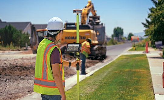
Juniper Systems, which has more than 30 years of experience in mapping and data collection in a wide variety of applications across industries, recently released a real time-kinematics (RTK) activation for its Geode GNSS receiver that allows mapping accuracy down to a centimeter. Pairing a Geode with the company’s Uinta mapping and data collection software and a Mesa rugged tablet makes it easy for users to share their data — such as the locations of fiberoptic telecommunication lines or of utility manhole covers — with other people working on site or at the office. The Geode and the Mesa meet IP68 protection certification for water and dust ingress; they also have MIL-STD-810G certification against drops, vibration, and extreme temperatures.
In this month’s cover image, the Geode is at the top of the survey pole, the Mesa Rugged Tablet is mounted near the user’s hand, and the screen on the Mesa depicts the Uinta mapping software.
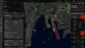
On construction sites, surveying is an ongoing process. Surveyors are the first on the site, before any other work begins, and the last ones there, to map the project “as built.” Total stations with GNSS receivers, as well as tablets and other mobile digital devices are their essential tools, increasingly complemented by unmanned aerial vehicles (UAV) and lidar scanners. Accuracy is their key contribution. In this month’s cover story on GNSS for architecture, engineering, and construction (AEC), we highlight three building projects: a skyscraper in Sweden, a highway in China, and a luxury resort in the Caribbean.
Check out these perspectives on architecture, engineering and construction:
ComNav Technology: Building Sweden’s Tallest Tower
CHCNAV: Expanding a Highway in China
EOS Positioning Systems: Building a System to Build an Island Resort