No audio available for this content.
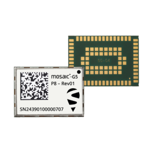
An exclusive interview with Stef van der Loo, market access manager, Septentrio. For more exclusive interviews from this cover story, click here.
What are your key markets and how does this port project fit in?
We have many markets, of course, but we have a big focus on machine automation, mainly for large industrial machinery. Think of agriculture and construction. Port logistics is a newcomer in a sense. In the last 20 years, there’s been a lot of testing with GPS receivers in terminals, but not as much as in construction because the two environments are very different. In a container terminal or port, everything is interconnected and, therefore, complex.
You can equip an excavator with a 3D system and import this data into a building information modeling (BIM) system, but sometimes data is missing and the system breaks. If that happens in logistics the whole chain breaks and you’re stuck. Lately, GNSS has become more popular, especially when coupled with inertial navigation, because the technology has become more capable of delivering centimeter-level accuracy even in challenging environments where the line-of-sight to GNSS satellites may be partially blocked by containers or structures.
So, GNSS is becoming more of a fit for the logistics market.
What have been the drivers of higher accuracy in the past 20 years?
The terminal operators want to increase their throughput of containers. Automation will not always speed up the handling of containers, because autonomous vehicles might move slower than those operated by experienced human operators.
In logistics they started looking at positioning to deal with the loss of containers. Every year, every terminal stacks a certain number of containers, but not all the information about them is given to the terminal operating system (TOS) automatically. If you keep on stacking but with missing data every container on top of a missed one will be wrong, so you fill your system with wrong data. Sometimes, operators must search for misplaced containers, which may require stopping operations and deploying additional personnel. Additionally, it is not very safe to go into these yards. This is one reason why ports began to deploy positioning systems. However, ten years ago, with meter accuracy, they were failing all the time. Now, improvements in the technology have enabled GNSS to become fit for the challenge.
Nowadays, in terminals, you see many non-GNSS positioning systems, such as radar systems, to steer cranes and position containers. We’re replacing many of these systems. There are also transponders in the roads, for vehicle traffic management and for area guided vehicles (AGVs), which are fully autonomous and need centimeter-precision everywhere. GNSS does not work everywhere. You always have some disruptions or gaps in coverage. However, the newer inertial systems can compensate for short GNSS outages so that you get reliable centimeter accuracy. Additionally, the cranes are increasingly automated. Gantry cranes, for example, are on rubber tires but constrained in their movements. Reach stackers, forklifts, and terminal tractors, on the other hand, have free movement. These vehicles are typically equipped with the GNSS or INS systems for traffic management or container and cargo positioning.
The next step would be to move to semi- or fully-autonomous vehicles, of course. GNSS is not enough for that; autonomous technology needs to have different sensors. It’s extremely difficult to prove and to test a new system in a terminal, because it’s an uninterrupted chain of interconnection between the sea, the stacking of the containers, and ground transportation. You cannot just go in with an autonomous forklift or an autonomous reachstacker and try out something. However, you can only prove it when you do it in that chain. Otherwise, it’s a standalone kind of test. So, that’s the biggest obstacle.
Don’t containers have a barcode you can scan or a serial number you can see with a camera?
Yes, they do. The problem is not so much the number on the container but its virtual number in the terminal’s layout. Let’s say that you put container A on square C1. What if you deviate half a meter and TOS puts it automatically in the system in C2 instead? That’s often where mistakes occur. So, you can have OCR scanners and easily scan the code on the container. The problem is where you place the container.
What about the virtual image of all the container stacks?
Yes, the digital twin, like in construction. However, in construction you don’t need the infrastructure. You don’t need to install a radar in a certain place, calibrate it, enter it in the maps, et cetera. That’s more the survey part of construction. The biggest win is when you can equip a vehicle with a standalone system. It needs RTK, but it is standalone for the port. You don’t need large infrastructure, you don’t need to drill holes every two meters to place transponders in the roads in the whole area, perhaps just a small part. That saves them a lot of investments and maintenance.
In terminals, you can use GNSS or INS systems for vehicle traffic management, autonomous vehicles and tasks, or to get the position of a container. For example, when a reach stacker reaches into a stack and locks a container in place, it’s crucial to have a very reliable centimeter-level position. Errors grow as the data is processed from the control systems to the TOS. To know for certain the position of a container when it was placed in a stack errors must not exceed half a meter. Therefore, the reliability and accuracy of the GNSS/INS is crucial for container positioning.
Many AGVs carrying containers still work with road transponders. But if we can assist with our GNSS and INS products, they may be able to make a hybrid form of terminal. In perhaps 80% to 90% of the terminal, GNSS/INS works fine because you have a relatively clear view of the sky.
We already play a big role with Kalmar. They are replacing all legacy positioning systems, which are often heavy on the infrastructure side. So, they’re stuck in their layout, they are not flexible anymore. To handle the positioning of the containers, they preferably do not use any fixed infrastructure. That’s one of the drivers within their SmartPort automation service. So, it’s for flexibility, for traffic management, automation and to position the containers.
The autonomous side is a whole other category. There are many semi-autonomous terminals and they’re partly closed, so nobody can enter them. There you need to do everything fully autonomously, of course, because there are no people inside. Here, too, the Septentrio systems play a role, similar to that of other autonomous vehicle markets. Yet the autonomous terminal evolution is still in its early days. The non-container logistics might take a leap here. We have an increasing number of customers who are developing or retrofitting autonomous logistics vehicles such as the terminal tractors, reach stackers and forklifts mentioned before, specifically for yards and factory plants.