The expanded role of positioning through advancements in GNSS
Individuals who use GNSS today may not know the significant advancements that have been accomplished over the past 30 years to obtain accurate GNSS-derived coordinates, especially GNSS-derived orthometric heights.
Thirty years ago, there were two limiting factors for estimating GNSS-derived heights — estimation of accurate ellipsoid heights in a timely manner and the availability of an accurate geoid model. The geoid model was only good to the decimeter level, between two stations relatively close together. A significant improvement of the measurement of the Earth’s gravity field (such as from the GRACE mission) and digital elevation data (from the Space Shuttle Radar Topography Mission) facilitated the creation of more accurate geoid models. Geoid models went from decimeter values to centimeter, and then sub-centimeter values between closely spaced marks.
A new national network
During the past three decades, the U.S. National Geodetic Survey (NGS) has developed a national network of Continuously Operating Reference Stations (CORS). These CORS, along with the states’ real-time networks (RTNs), have provided the ability to compute accurate GNSS-derived coordinates in an efficient and effective manner. The modeling of antenna phase patterns was a critical development for combining different types of antennas.
Today’s GNSS processing software is basically a “hands-off black-box” system. But 30 years ago, the analyst had to identify cycle slips and ensure that all unknown cycle ambiguities of the carrier-phase data (integers) were determined correctly. It was a time-consuming task, and analysts needed to understand the data. So many things can go wrong when someone relies on an answer from a black box. That said, federal agencies such as NGS and GNSS software companies have produced hands-off software that provides statistics and warning messages, as well as guidelines for ensuring results are consistent and accurate.
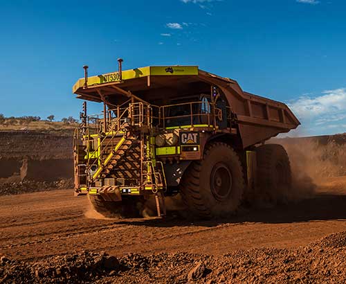
The advancements in estimating GNSS-derived coordinates (including orthometric heights) have changed the way many industries do business. Farmers use it to drive their tractors and combines, mining companies control driverless vehicles, construction companies use automated machine guidance to build roads, and, of course, it has improved how individuals navigate from one location to the next.
Hands-off farming and mining
Thirty years ago, few farmers thought they would be able to sit in their cab and let their combine harvester drive itself. Geodesist, surveyors, and engineers had a vision of using GNSS to automate the use of farming and construction equipment, which became a reality.
What will it be like in another 30 years? Will it be routine for individuals to program their car for a destination, and then sit back and read a book?
Positioning with GNSS will be critical for the safety factor of driverless vehicles and the use of drones for delivery. Geodesists, surveyors and engineers, once again, need to lead the way to meet the positioning requirements of the future.


Follow Us