TAG: multipath

FIGURE 4. Test road at The Green Village, with three of the five roadside transmitting antennas (TX-3 to TX-5) as indicated. In the foreground, the receiver antenna is mounted on a trolley.

Innovation: A terrestrial networked positioning system

May 14, 2022

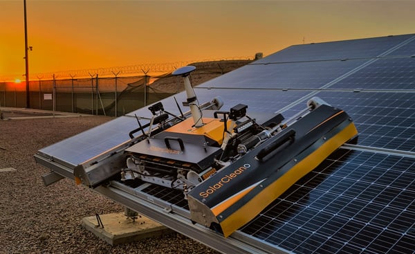
A SolarCleano F1A robot tackles a tough cleaning challenge on a solar farm in Saudi Arabia. Photo:: SolarCleano

Swift Navigation, SolarCleano: cleaning robots keep solar power running

April 7, 2022

NAVISP includes projects for autonomous and connected driving. (Image: ESA/F. Bagiana)

ESA seeks ideas to augment satnav with imaging sensors, 3D maps

June 21, 2021

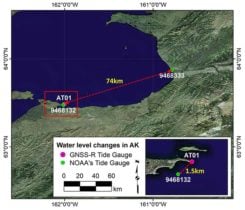
FIGURE 3. Locations of AT01 and two NOAA tide-gauge stations (9468132 in St. Michael and 9468333 in Unalakleet). The red box represents the zoomed area at the bottom right. (Image: Authors)

Innovation: Monitoring sea level in the Arctic using GNSS

October 21, 2019

Image: Spirent

Spirent Sim3D provides realistic multipath simulation

August 29, 2019

Satellite selection algorithm. (Image: NTT/Furuno)

New GPS receiver uses multipath for better time synchronization

November 1, 2018

Image: GPS World

Simulating multipath in real time for receiver evaluation

March 16, 2018

Source: Richard Langley

Innovation: Position estimation using non-line-of-sight GPS signals

March 15, 2017