Listen to this content
Scientific Systems has released upgrades for ImageNav, an image-based navigation software designed for GPS-denied or compromised environments.
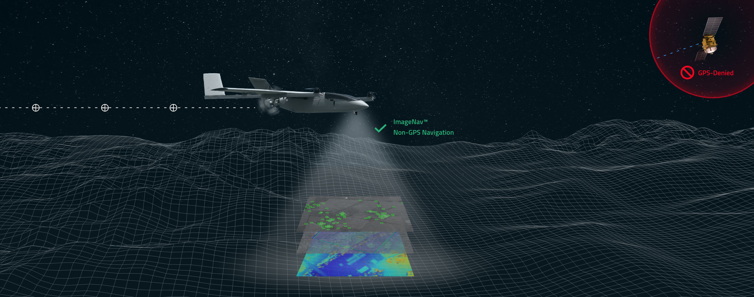
With more than a decade of development, ImageNav offers a robust alternative to traditional GPS navigation for military operations, particularly in contested environments where jamming poses a threat to GPS reliability.
The demand for such technology has become increasingly critical considering enhancements to electronic warfare capabilities, with instances of GPS signal disruption impacting military assets. ImageNav is designed to address GPS vulnerability by offering precise navigation for a wide range of systems, including weapons, aircraft and uncrewed aircraft systems (UAS), without reliance on GPS signals.
ImageNav uses an onboard electro-optical (EO) or infrared (IR) digital camera and can employ three algorithms to analyze captured images and correlate them with stored terrain and image references. This process allows both absolute and relative navigation position updates. The technology can be integrated into air platforms as a software upgrade or as part of a self-contained hardware payload, minimizing size, weight and power (SWaP) requirements.
Scientific Systems is actively pursuing the integration of ImageNav onto GPS-guided munitions and UAS to operate in environments where GPS access is denied. Recent testing has demonstrated the technology’s capability to navigate without GPS and hit targets within required performance parameters.