No audio available for this content.
MetaGeo has launched a geographic information system (GIS) platform to enable organizations of all sizes to host, analyze, find and share 3D map datasets among any internet-capable devices.
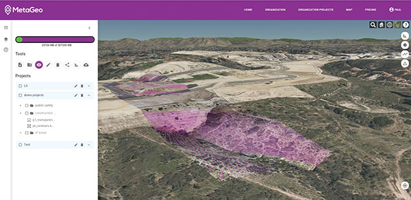
The platform processes location-based map or sensor data from the real world, combines it into a single 3D virtual environment, and streams it to any device or mapping platform.
The affordable and easy-to-use platform can load data from multiple sources: satellites, drones, mobile devices, public and crowdsourced repositories, internet of things (IoT) sensor data, 3D models and topographic maps.
The data is then processed by the MetaGeo platform into a 3D world and streamed to any internet-connected device, enabling live collaboration between the office and field via mobile or AR device. A plug-in software development kit (SDK) allows for third-party tools to scale and fit user needs.
Applications include academia, architecture, engineering, construction, energy, natural resource management, environmental monitoring, utilities and public safety. Uses include planning and managing construction sites, organizing layouts of events, creating maps for public safety, and visualizing inspection imagery from drones and mobile devices.


