No audio available for this content.
Raytheon’s F-35 precision landing system can be set up anywhere in less than 1.5 hours
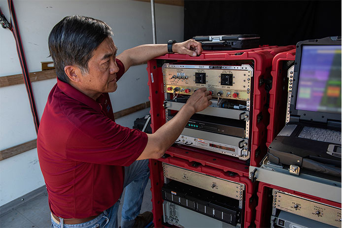
A Raytheon Company team has conducted a rapid set-up demonstration of a land-based expeditionary version of its Joint Precision Approach and Landing System (JPALS) to a group of global military officials at Naval Air Station Patuxent River, Maryland.
JPALS is a GPS-based precision landing system that guides aircraft to precision landings in all weather and surfaces conditions.
“The entire system was fully operational in 70 minutes on Day One and 50 minutes on Day Two,” said Matt Gilligan, vice president at Raytheon’s Intelligence, Information and Services business. “Raytheon is offering the U.S. and its allies fast and accurate precision landing systems that support operations from bare-base locations.”
During the demonstration, military officials from all four services, as well as representatives from Japan, United Kingdom, The Netherlands and Italy, watched multiple F-35Cs land on the same designated runway landing point every time over the course of six different approaches.
This was the second proof-of-concept event in 2019 showing how F-35s can use a reconfigured mobile version of JPALS to support landings in austere environments.
JPALS is a differential, GPS-based precision landing system that guides aircraft onto carriers and amphibious assault ships in all weather and surface conditions up to the rough waters of Sea State 5. It uses an encrypted, jam-proof data link to connect to software and receiver hardware on the aircraft and an array of GPS sensors, mast-mounted antennas and shipboard equipment.