No audio available for this content.
Geoscience Australia is undertaking an assessment of the economic impact of the National Positioning Infrastructure Capability (NPIC) program.
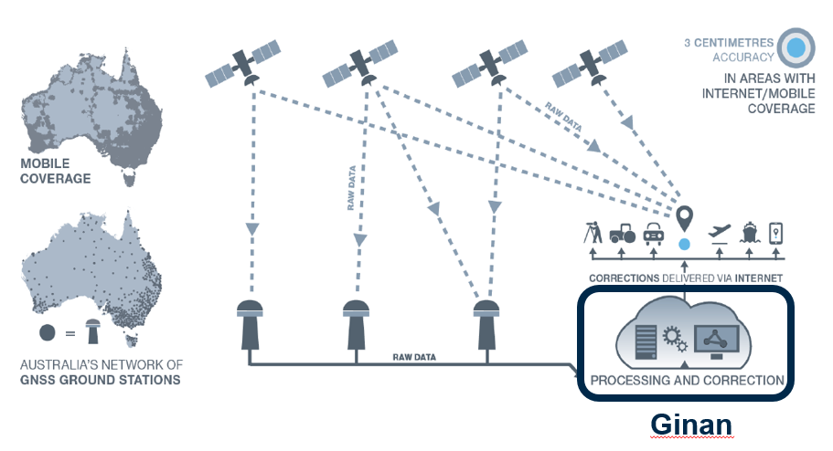
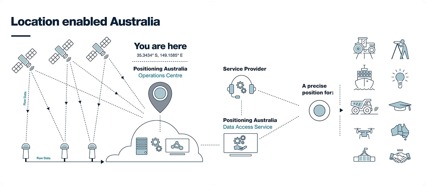
The program provides free and open access to multi-GNSS observation streams from Australia’s network of continuously operating reference stations (CORS).
Users can connect to these data and product streams directly from Geoscience Australia or via a commercial positioning-service provider. The CORS network has been designed to support a national positioning capability that provides better than 5-cm accurate positioning solutions in areas with access to mobile-phone coverage (delivery via the internet).
Geoscience Australia has engaged ACIL Allen to conduct a web-based survey for stakeholders with interest in this program to assist with data gathering for the economic assessment.
The survey takes 15 to 20 minutes to complete. There is an additional optional component for service providers that may take an additional 15 minutes.
It can be completed in stages, if necessary, with a facility to save responses. It will remain open until June 28 (extended from May 25).
Questions can be directed to Alan Smart (project director) at 0404 822 312 or Nanumi Starke (ACIL Allen) at 0466 636 345.


