No audio available for this content.
FrontierSI has signed a collaborative agreement with Geoscience Australia, Curtin University and the University of Newcastle to enhance Ginan with features specifically aimed at supporting low-Earth orbit (LEO) satellites as an important component of Geoscience Australia’s Positioning Australia program.
Ginan is Geoscience Australia’s GNSS analysis center software. It delivers a real-time positioning correction service through open-source software and additional positioning products to enable precise point positioning for Australian industry and users.
The design, development and deployment of LEO satellites has grown significantly over the last decade. The agreement with FrontierSI complements ongoing Ginan precise orbit determination (POD) development activities, focusing on the implementation of LEO satellite modeling and the orbit integrator/propagator capabilities needed to enable LEO GNSS data to be processed and high-precision LEO satellite trajectories estimated and predicted.
Such a capability will enable:
- better monitoring of LEO satellites for station keeping, collision avoidance and end-of-life purposes
- improved ionosphere and troposphere monitoring and modeling through the analysis of GNSS signal occultation, to provide data for weather prediction and precise positioning purposes.
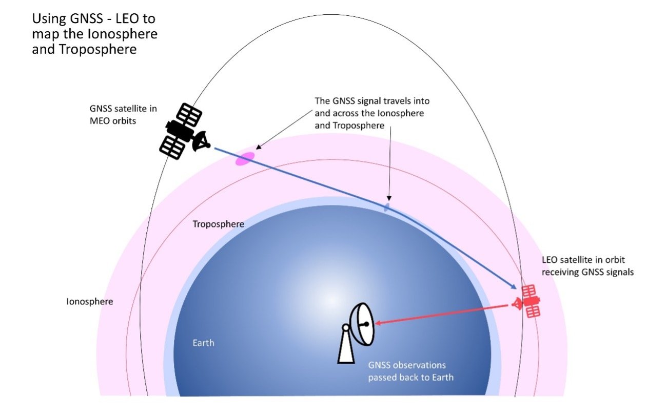
Image: Ginan
Learn more about Ginan here.


