No audio available for this content.

Flowfinity Wireless Inc. has released new functionality that allows field users to collect highly precise GNSS location data via external Leica Zeno GG04 plus Smart Antennas in Flowfinity applications.
This powerful new capability assists organizations in the engineering, environmental consulting, construction and public utilities sectors that use custom mobile data collection apps built with Flowfinity to survey and inspect work sites.
The Zeno GG04 plus is a rugged, flexible and easy-to-use smart antenna from Leica Geosystems, part of Hexagon. It uses RTK technology and Precise Point Positioning (PPP) to make high-accuracy data collection possible in real-time even in demanding locations without the need for a mobile data connection.
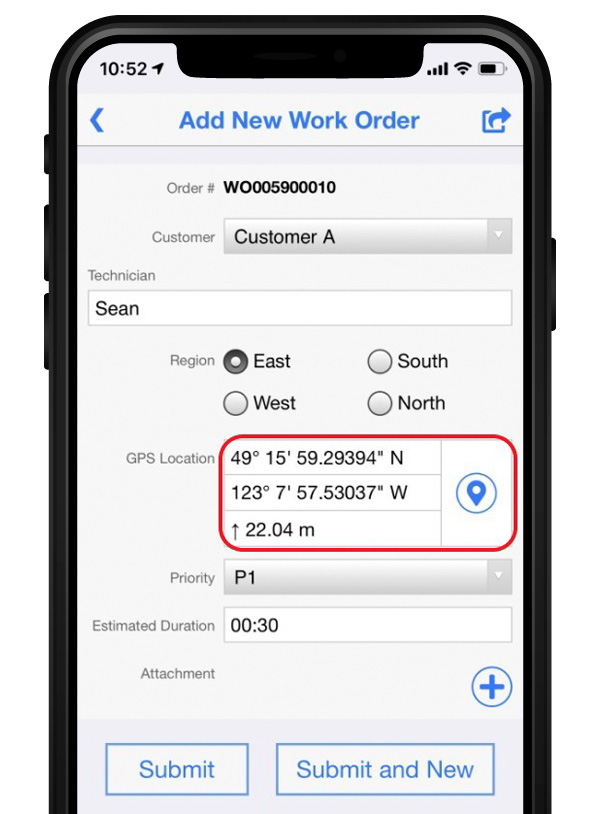
The combination of state-of-the-art Zeno GNSS technology with the workflow automation features in Flowfinity Actions is a game-changing update that will save hours in the field while providing location data accurate to five decimal places for analysis in the office.
“This is an exciting update for any organization that needs to record accurate site survey data as part of their digital mobile workflows,” said Larry Wilson, VP Sales & Marketing, Flowfinity. “Field users in engineering and related industries can now collect some of the most precise GNSS readings possible and have that info available in their existing Flowfinity applications. This opens up significant opportunities to become more efficient on-site.”
All Flowfinity applications deployed on Android and iOS devices can now leverage the Leica Geosystems antenna to achieve 5 decimal place accuracy for GNSS location data.
For example, if an environmental consulting firm needs survey quality GNSS data to be collected and submitted during site inspections, they can now deploy field workers with Leica GG04 plus Smart Antennas to record data directly into their Flowfinity mobile applications, rather than performing manual data entry or relying on much less precise data from internal mobile device sensors.
Flowfinity is used across industries including environmental services, engineering, construction, municipal governments and utilities for driving efficiency and streamlining operational workflows.
Go here for complete list of new features.


