
No audio available for this content.
Israeli drone service provider ERELIS has conducted a number of pilot projects using a drone equipped with a single-beam echo sounder in the Mediterranean Sea and the Dead Sea. The data was validated by authorized local surveyors and reports from previous surveys of the same areas by the Michmoret Campus, Faculty of Marine Science.
The reference bathymetric data was collected using a manned boat and multi-beam and single-beam echo sounders and demonstrated a good match between the results of new drone-based and traditional methods.
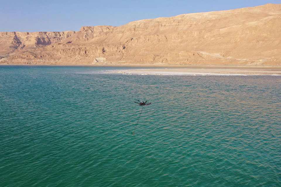
The bathymetric system consisted of a standard commercial DJI drone (UgCS SkyHub onboard computer and terrain-following system with radar altimeter) and Echologger ECT400 single-beam echo sounder provided by SPH Engineering, Latvia. For data processing, the Eye4Software Hydromagic software package was employed.
“I was surprised by the maneuverability of the system and how easy it is to conduct bathymetric surveys using a UAV equipped with an echo sounder,” said Roman Kirsanov, CEO of ERELIS. “Some of our survey areas were 400 to 500 meters away from take-off and landing positions, and that means that remote sensing comes to the world of hydrography and becomes available to any drone service companies.”

“It was good to see that applicability of our system with a single-beam echo sounder validated in conditions outside of its initial focus on small-scale surveys of inland water bodies,” said Alexey Dobrovolskiy, CTO of SPH Engineering. “We can now recommend our system for small-scale surveys in coastal areas and virtually in any liquids. The density of water in the Dead Sea is 1.24 kg/l.”
In May, SPH Engineering launched a UAV integrated with an echo sounder, as a new product for bathymetric surveys of inland and coastal waters. This data-collection method has since been used in Denmark and the UAE, and is suitable for mapping, measuring and inspections, as well as environmental monitoring.


