No audio available for this content.
U.S. cellular carrier AT&T is rolling out location-based routing to automatically transmit wireless 9-1-1 calls to the appropriate call centers.
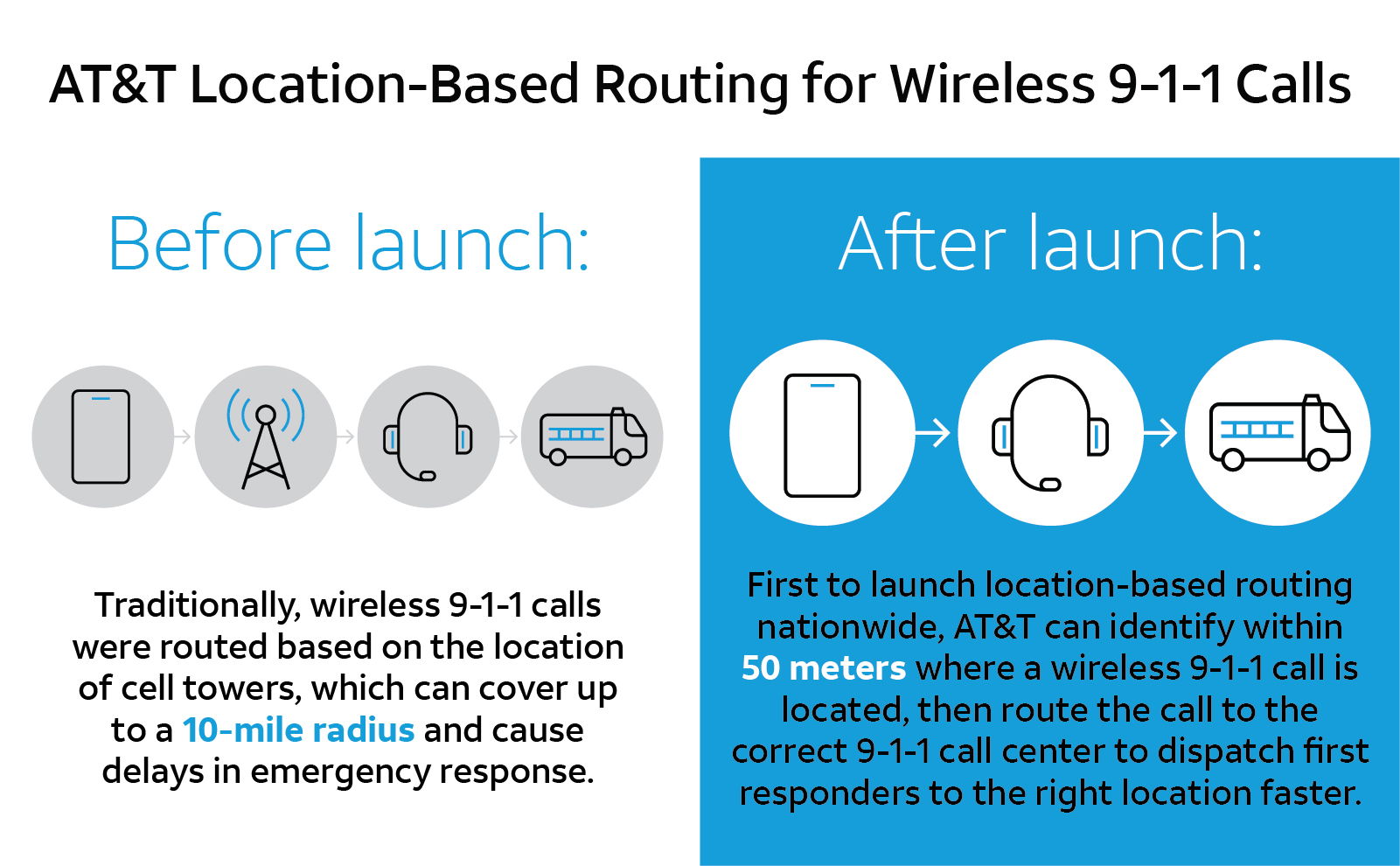
Traditionally, wireless 9-1-1 calls were routed based on the location of cell towers, which can cover up to a 10-mile radius. This can cause delays in emergency response, especially when a call is made where state, county or city boundaries overlap.
With location-based routing, a device can be located and routed within 50 meters of the device location. Through a new “Locate Before Route” feature from Intrado, AT&T can quickly and more accurately identify where a wireless 9-1-1 call is coming from using device GNSS and hybrid information to route the call to the correct 9-1-1 call center.
The nationwide rollout has started and is available in Alaska, Colorado, Hawaii, Idaho, Montana, Oregon, Washington, Wyoming, Kansas, Illinois, Iowa, Minnesota, North Dakota, Missouri, Nebraska, South Dakota and Guam. Additional regions will be rolled out over the next several weeks. The nationwide rollout is scheduled to be completed by the end of June.