No audio available for this content.
Site-survey preparations for a windfarm of 20 300-foot tall wind turbines might have been quite complex for a location in a 2,500-foot-high valley in the Swiss Alps.
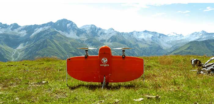
However, the contractor decided to use a drone with vertical take-off and landing (VTOL) capability supplied by Wingtra to speed up the work and produce highly accurate geo-referenced data. Although multirotor drones are normally used for detailed survey work, they can cover much less area than fixed-wing drones during the same flight time. Fixed-wing drones can fly longer, farther and carry more weight.
Multicopters tend to carry more expensive, higher accuracy sensors because the sensors are not subject to potential damage from fixed-wing belly landings. Wingtra solved this problem by developing a drone with vertical take-off, the ability to transition to horizontal flight and to then land upright. When equipped with heavier, more accurate sensors, longer and more complex surveys are possible.
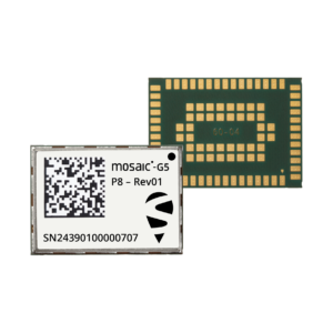
The Septentrio AsteRx-m2 was also chosen for the WingtraOne drone. The AsteRx-m2 is a high-precision, multi-frequency, four-constellation, PPK, low weight and power GNSS module. The low-latency AsteRx-m2 works for both rotorary- and fixed-wing UAV applications.
The WingtraOne VTOL drone is able to cover 400 hectares (an area of around 570 football fields) in one 55-minute flight. The resulting mapping accuracy is as high as 1.27 centimeters (0.5 inches). The drone was equipped with the full-frame 42MP Sony RX1RII camera, with seven ground control points for increased accuracy.
The WingtraOne took off vertically and transitioned to fly horizontally at the planned 1,500-foot altitude. Each flight took about 20 minutes to plan and involved 30 minutes of flying time. The flights covered a total area of 1,100 hectares — each flight was 200–300 hectares.
Aerial data collected from the site was converted to 3D models that allowed visualization of planned roads and wind-turbine locations in the wind farm. The data-collection workflow only took 4 hours rather than the days required with traditional surveying. Use of high-end sensors ensure survey-grade imagery and accuracy — in this case, the engineers obtained an accuracy of 3–4 cm.
Flying in an area as difficult as the Swiss Alps to collect aerial data has been one of Wingtra’s most complicated challenges. By reducing costs and the time to complete the survey and evaluation of the proposed site, the customer was able to maintain the overall wind farm project timelines.