No audio available for this content.

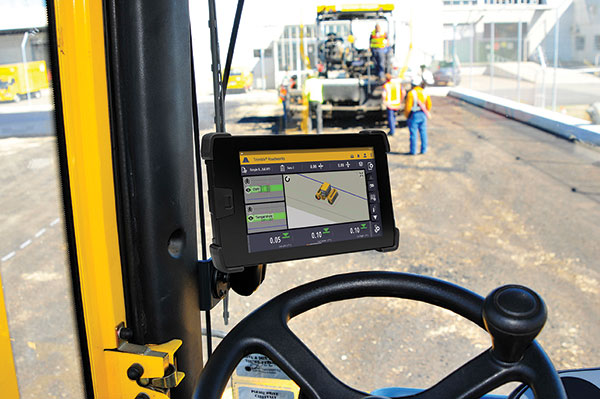
Trimble has introduced Trimble Roadworks Paving Control Platform for Asphalt Compactors. It enables operators to accurately control the compaction process, while reducing unnecessary passes that can result in over compaction. The highly accurate, 3D paving control system is designed to improve the speed, accuracy and ease of asphalt compaction.
The system leverages the highly intuitive Android-based Trimble Roadworks software to maximize ease of use, shorten training times and decrease downtime for operators already familiar with the Roadworks user interface. With the proper hardware and software configurations, the new system is flexible and can support a variety of jobsite needs and specifications.
Roadworks helps contractors save on fuel costs and reduce both machine wear and tear and operator hours. In addition, asphalt temperature mapping provides color-coded data to allow operators to compact at the correct temperature, reducing material waste and rework.
In addition to helping operators achieve greater accuracy and efficiency, Roadworks is available at various pricing levels to help meet the needs of each contractor. New compactor licenses make it possible for contractors to pay for only the functionality they need, and office-only licenses provide increased functionality in the office. Users can also benefit from ongoing Roadworks platform development.
“We’re expecting there to be an influx of projects over the coming months and years as the result of increased infrastructure funding,” said Kevin Garcia, general manager, Trimble Civil Specialty Solutions. He said the release was important because more departments of transportation and private owners are building technology requirements into their requests for proposals (RFPs).
Connected Site Functionality. Roadworks is compatible with Trimble WorksOS and Trimble WorksManager software. This enables contractors to send construction-ready models from the office to the machine as well as to remotely monitor jobsite progress and activity. In addition, productivity data collected from the machine is automatically synced back to the office.


