L3Harris explains how ENVI is used for disaster response at Esri UC 2019
August 6, 2019
At the Esri 2019 User Conference, L3Harris’ Zachary Norman discusses how the company’s ENVI® (Environment for Visualizing Images) […]
Read More

At the Esri 2019 User Conference, L3Harris’ Zachary Norman discusses how the company’s ENVI® (Environment for Visualizing Images) […]

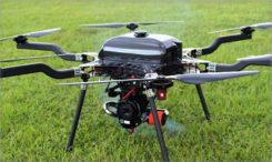
Lidar USA is integrating its UAV scanning systems with the Harris Aerial H4/H6 Hybrid multicopters. As surveyors and […]

L3Harris Technologies announced the successful completion of the all-stock merger between Harris Corporation and L3 Technologies on June […]

Grand Sky Business and Aviation Park and Harris Corp. have joined forces to enable the country’s first and […]

Rebecca Lasica, director of enterprise platforms and partners at Harris Geospatial Solutions, offers a rundown on the company’s […]

QZS-2 signal analysis, QZS-3 launched The second satellite of Japan’s Quasi-Zenith Satellite System (QZSS) has started transmitting navigation […]

Harris Corporation and the National Geospatial-Intelligence Agency (NGA) are partnering to provide industry training for NGA employees, including […]
Follow Us