No audio available for this content.
Scientists continue to search for new technologies to serve the PNT mission. One novel way to augment GPS comes from a newly developed technology involving a quantum magnetometer.
Researchers at Lockheed Martin call it Dark Ice; it uses magnetic sensing as an alternative means of determining location without use of satellite signals.
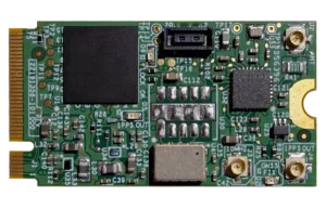
Mike DiMario and his team have developed a prototype magnetometer that uses a synthetic diamond the size of a salt crystal to measure the direction and strength of nearly imperceptible magnetic field anomalies. They overlay that data with maps of Earth’s magnetic field, supplied by the National Oceanic and Atmospheric Association, to produce precise location information.
Special quantum-level impurities in the molecular structure of the diamond, where intermittently a carbon atom drops out and its neighbor is a nitrogen atom, enable the detection of magnetic field waves. These nitrogen vacancy (NV) centers are hyper-sensitive magnetic sensors. When illuminated by a laser, the diamond emits more or less light depending on the surrounding magnetic field’s strength.

Position + Direction. Dark Ice differs from current magnetic sensors aboard ships and planes in that it can measure both the field strength and the direction the field is pointing. “The real advantage of this quantum-based technology is its ability to produce a true magnetic field vector, while at the same time having a very large dynamic range and bandwidth,” DiMario explained.
Project development “was like peeling an onion: with each new layer removed, the team advanced. We had no idea of the expected outcome, other than what system modeling, the laws of physics and good engineering could predict. There was always something we could not have predicted or even thought of.”
In addition to developing this navigational capability, the team has also demonstrated that Dark Ice can harness Earth’s magnetic field to transmit communications across barriers intended to block all traditional signals, and track moving vehicles in real time.
Unjammable. “This project was designed for times when extenuating circumstances might prohibit your use of traditional GPS signals, and you need something that is unjammable, passive and always available. The Earth’s magnetic field meets this description if we can adequately sense and make use of it,” DiMario said.
He wants to downsize Dark Ice to hockey-puck size for convenient use on multiple platforms. “In real-world conditions, if I can get within 200 meters of GPS accuracy, that would be a huge success,” he claimed. Such precision would serve as a backup or verification to GPS, not a sole-means navigation system.
With its powerful sensing capabilities and small size, Dark Ice could function as the most reliable way to do things like identify hard-to-find watercraft in search-and-rescue missions and fly aboard aircraft in the battlefield. Navigation, search and communications — all in one compact sensor.