Listen to this content
Leica Geosystems, part of Hexagon, has introduced the Leica X-PAD portfolio, which combines field software, surveying instruments and connected services for routine surveying applications.
The portfolio is built around X-PAD workflows previously used by GeoMax customers and is designed to support a range of everyday field surveying tasks.
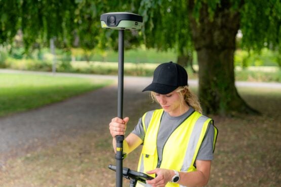
Among the products introduced with the portfolio is the Leica GS11 GNSS smart antenna, which adds augmented reality guidance and image-based measurement capabilities to field workflows.
Using the GS11, surveyors can navigate to points using live site imagery, review captured data before leaving a site and measure points from captured images, including locations that may be difficult or unsafe to access with a survey pole.
Leica Geosystems positions the new portfolio within its broader range of surveying and construction technologies. Leica Captivate is intended for complex surveying projects, Leica iCON focuses on construction workflows, and Leica X-PAD is designed for a select range of routine surveying tasks.
Field views and image-based measurements
Leica X-PAD enables field teams to work with survey information in 2D, 3D, map and site views, including drawings, surfaces and BIM data.
When used with the GS11, the software can overlay stakeout guidance and design or captured data onto live site imagery. Surveyors can also use captured images to measure additional points and review collected information before leaving the site.
Compatible instruments and connected services
The Leica X-PAD software is compatible with several Leica Geosystems instruments, including the new GS11 GNSS smart antenna, the Leica GS05 GNSS smart antenna and the Leica TS13 robotic total station.
Leica X-PAD Fusion extends the workflow into the office, while Hexagon GeoCloud supports field-to-office data exchange and Hexagon SmartNet provides GNSS positioning services.
The portfolio builds on X-PAD technology previously used by GeoMax customers. Leica Geosystems said development and support will continue for both Leica Geosystems and GeoMax instruments. GeoMax products will remain available, with technical service continuing through existing channels.
Leica Geosystems said its GeoMax partners will also join the Leica Geosystems network in bringing Leica X-PAD to market.