No audio available for this content.
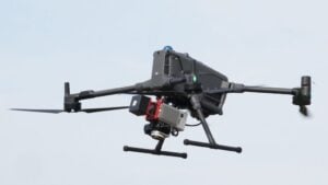
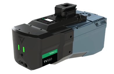
GeoCue has announced the latest addition to its Standard aerial lidar portfolio with the launch of the TrueView 550, a high-performance mapping system designed to advance the capabilities established by the TrueView 539 and TrueView 540.
Users can choose between GeoCue’s TrueNav GNSS-inertial navigation system or the Applanix APX-20. The TrueView 550 combines next-generation lidar and dual 20 MP cameras with an expanded field of view to deliver detailed, accurately positioned, colorized point clouds, the company said. It is the highest-performing TrueView sensor in GeoCue’s Standard range.
The 550 is designed to deliver performance approaching higher end aerial lidar systems at a more accessible price point. It provides surveying, engineering and geospatial professionals with a new balance of range, accuracy, imaging capability, performance and value, the company said.
At the core of the TrueView 550 is the latest lidar scanner technology, engineered for aerial surveying applications ranging from traditional topographic mapping to challenging, high-relief terrain.
The lidar technology supports ranging capabilities of up to 2,100 meters and typical flight altitudes ranging from 100 to 600 meters AGL, giving operators greater flexibility when planning projects over varying terrain and larger project areas. Advanced waveform processing helps improve point-cloud density and data completeness, while the scanner is capable of collecting up to 1 million points per second at 120 meters AGL, providing the detailed 3D information required for professional mapping applications.