No audio available for this content.
Core Beta Products and Tools Made Available for Public Testing
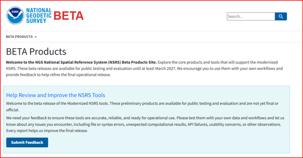
In recent newsletter articles, I’ve covered the National Geodetic Survey’s modernization of the National Spatial Reference System (NSRS). NGS has now released Core Beta Products and Tools for users to test and provide feedback ahead of adopting the new NSRS. See the “Core Beta Products and Tools” box for details.
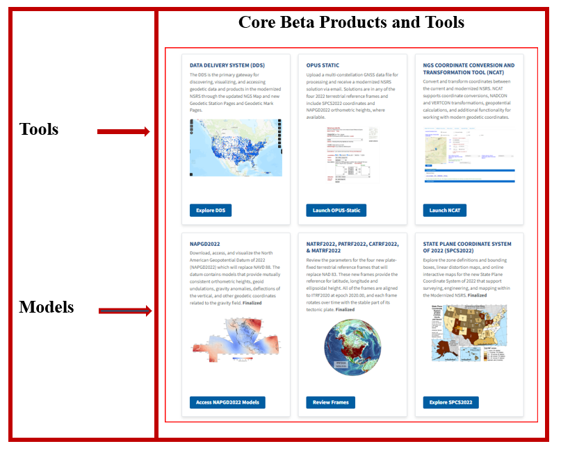
After at least six months of testing, these Beta routines can advance to production, and NGS will formally publish the modernized NSRS. As noted in my previous newsletter articles, this modernization marks a major shift in how geospatial data — and, by extension, engineering and construction projects — are defined in the United States. Surveyors, engineers, construction firms, and other geospatial users should be aware of four key impacts: (1) Shift in Datums, (2) Time-Dependency, (3) Transition and Compatibility, and (4) Preparation Requirements. I’ll cover these in upcoming issues. As you’ll see in the “Core Beta Products and Tools” box, several products and tools have been released. This article highlights the Data Delivery System (DDS), now available for public testing and feedback.
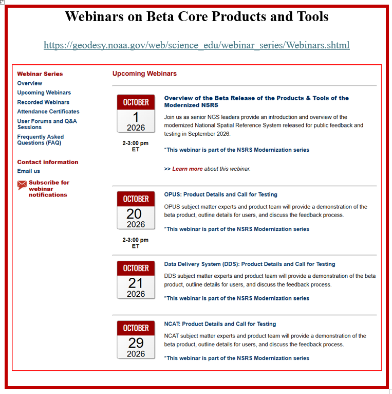
Over the coming weeks, NGS will host a series of public webinars detailing each product and the broader impacts of NSRS modernization on geospatial workflows. The first webinar, held on October 1, 2026, provided an overview of the Core Beta Products and Tools. Subsequent sessions will dive into each Beta product. See the box titled “Webinars on Beta Core Products and Tools.”
As previously noted, this issue spotlights the Data Delivery System (DDS) that NGS has released for public testing and feedback.
The DDS is the primary gateway for discovering, visualizing, and accessing geodetic data and products in the modernized NSRS. It unifies a modernized NGS Map with two new products:
- Geodetic Station Pages: They replace current NOAA CORS Network (NCN) station pages; they provide station metadata, reference epoch coordinates, updated CORS coordinate functions (CCFs), and related geodetic products.
- Geodetic Mark Pages: They replace current ASCII datasheets with interactive pages that deliver mark metadata, reference epoch coordinates, and related geodetic products.
This system is critical because, once the new NSRS is adopted, users will rely on the DDS to retrieve information about CORS and geodetic marks.
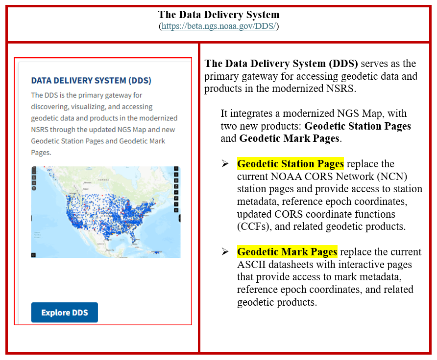
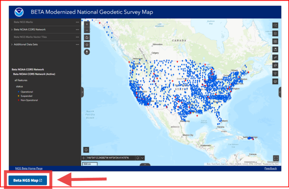
Clicking on the Explore DDS button brings up the Beta Map website.

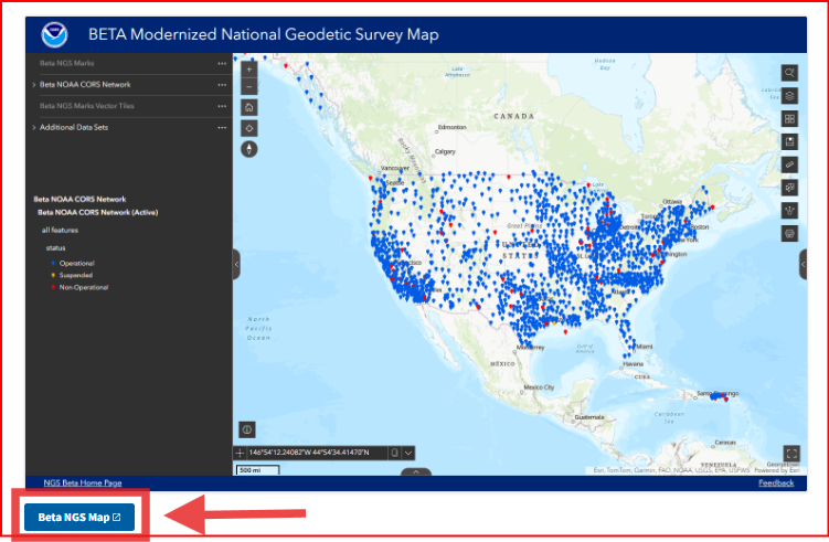
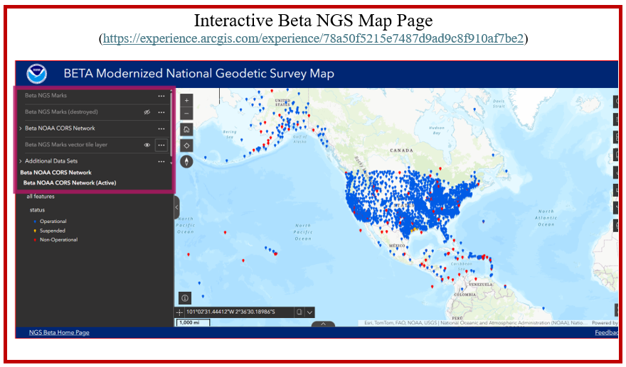
Clicking the Beta NGS Map button opens the interactive map with available data layers. From these layers, users can view geodetic marks in the NGS database (both available and destroyed) and NOAA CORS stations (both active and non-operational).
Layers of available data
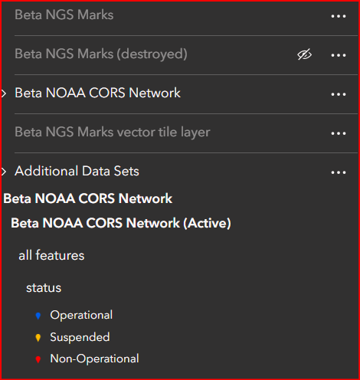
The Beta NGS Map page opens an interactive map of the NOAA CORS Network.
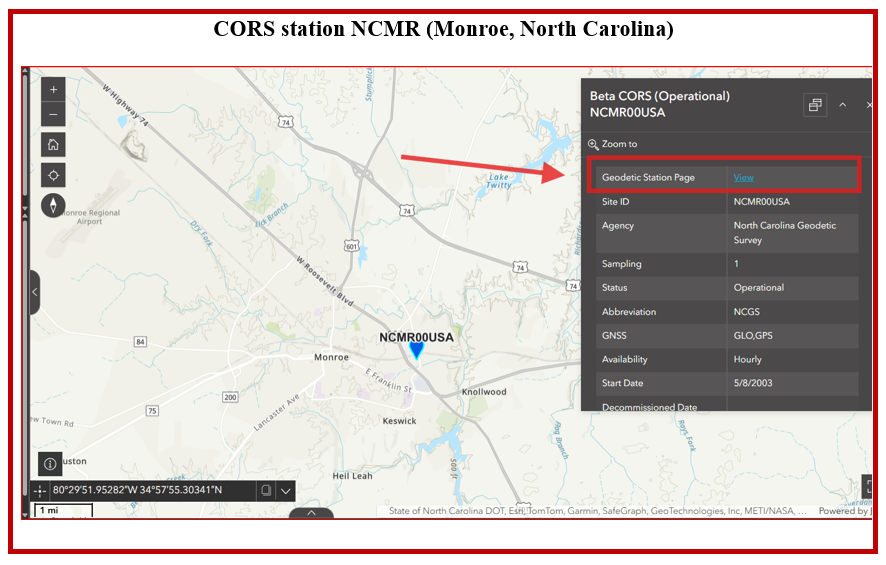
Click any station to view its details, including metadata and available products. See the box titled “CORS station NCMR (Monroe, North Carolina).”
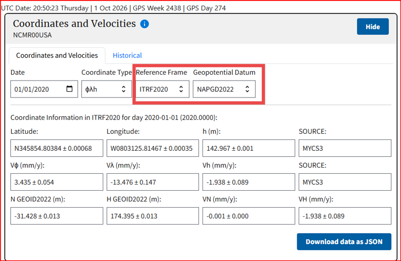
Selecting Geodetic Station Page displays the station’s coordinates and velocities, along with ellipsoid and geoid heights. You can choose the reference frame — ITRF2020, NATRF2022, CATRF2022, MATRF2022, or PATRF2022. The page also includes the station’s installation date, a map showing its location and nearby CORS stations, equipment details, photos, additional resources, and plots for position, residuals, daily observations, cycle slips, latency, and multipath.
ITRF 2020 Coordinates of CORS NCMR
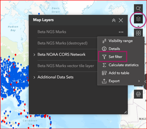
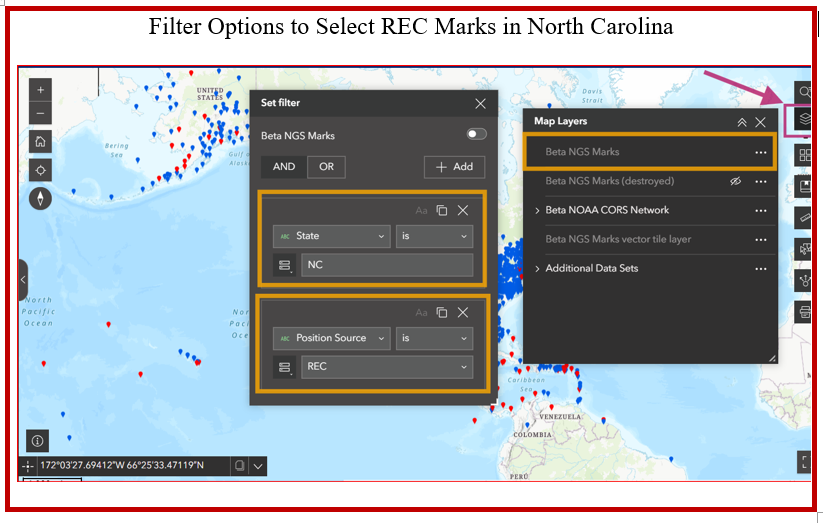
Most users will focus on Beta NGS Marks with Reference Epoch Coordinates (RECs). The dataset includes all NGS marks, but only some have RECs — marks with a Position Source of “reported” do not. Marks included in the NAD 83 (2011) adjustment are expected to have RECs. To display only marks with RECs, use the Set Filter tool.
Set Filter Tool in Map Layers
Users can select marks based on the attributes in the map layer. This is the box titled “Attributes of Marks in the Beta Map Layer” for the attributes for the Beta NGS Marks Map Layer.
Attributes of Marks in the Beta Map Layer
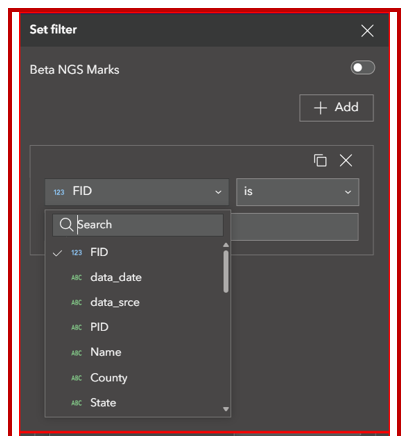
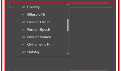
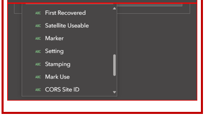
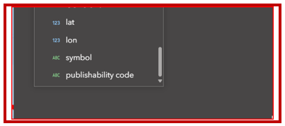
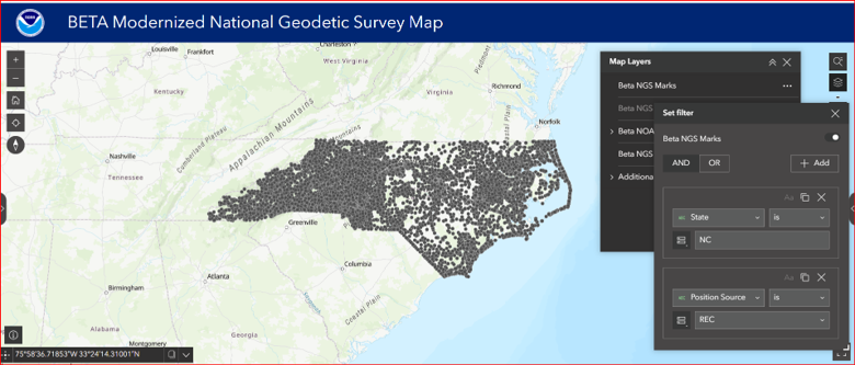
Using Set Filter, I displayed only North Carolina marks with Reference Epoch Coordinates (RECs) by setting State = NC and Position Source = REC. (See the box titled “Filter Options to Select REC Marks in North Carolina.”) The box titled “Marks with RECs in North Carolina” shows the results.
The plot below shows that North Carolina has a high density of marks with RECs.
Marks with RECs in North Carolina
The tool automatically compiles these marks into a table.
Table Function
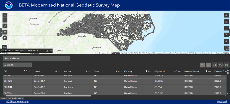
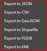
The table appears after you click the tab below the plot of the marks. You can download the data using the “Export” option.
Export Feature
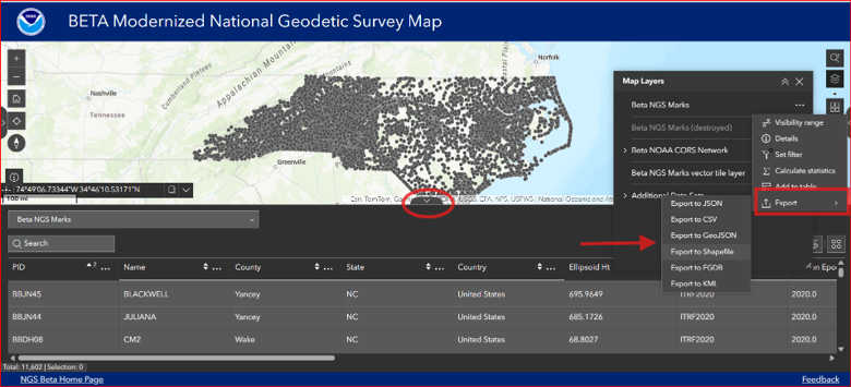
There are several options for downloading:
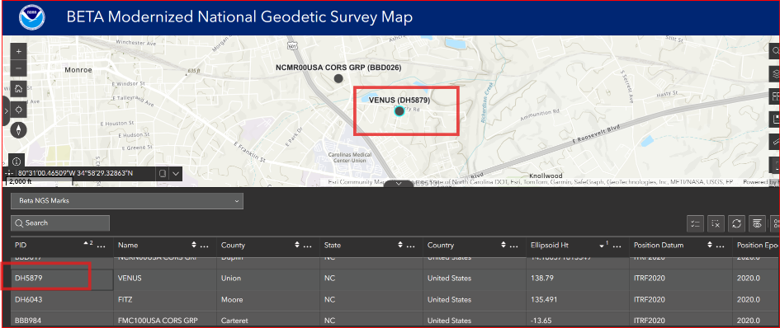
After you find a mark of interest, click its PID in the table to zoom the map to that mark.
Zoom to a Mark
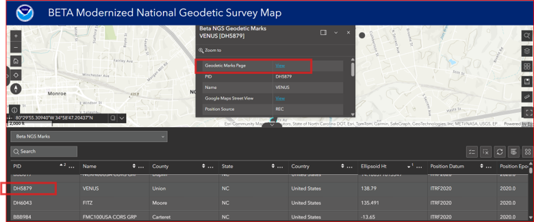
Then users can click the mark’s icon to open its Geodetic Mark Page.
The Geodetic Mark Page provides the coordinates of the mark and allows the user to access the archived datasheet.
Geodetic Mark Page for PID DH5879
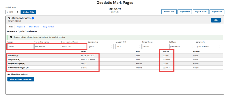
Users can select the Geometric Frame in which they are working (NATRF, CATRF, MATRF, and PATRF).
Select the Geometric Frame
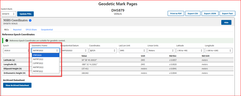
NATRF2022 Coordinate for PID DH5879
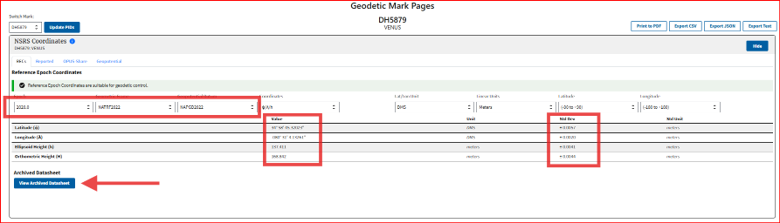
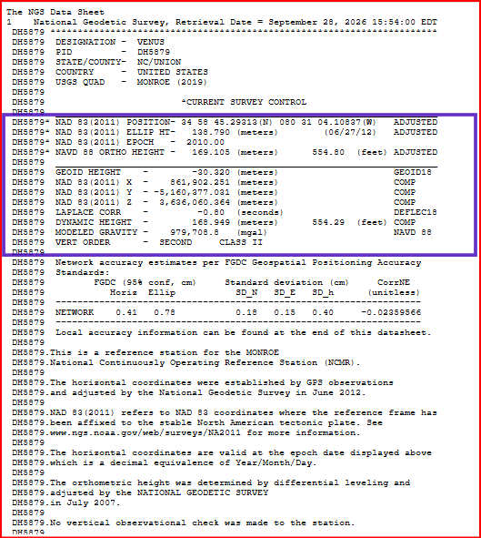
Clicking on the View Archived Datasheet brings up the datasheet for the PID selected.
Datasheet for PID DH5879
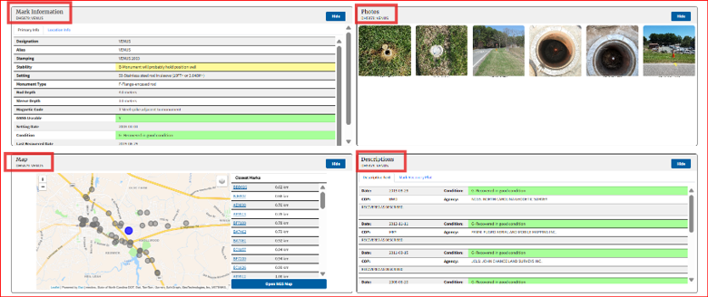
The Geodetic Mark Page also includes mark details, photos (when available), a location map showing nearby marks, and a descriptive summary.
Mark Information and Map for PID DH5879
I’ve highlighted a few core features of the Beta NGS Map. For a quick walkthrough, NGS provides a concise, high-quality tutorial that I highly recommend—it’s brief and very helpful for navigating the map tool.
https://geodesy.noaa.gov/datasheets/ngs_map/tutorial.shtml
Your most important role right now is to use the Beta tools and share your feedback with NGS. These are the tools that will roll into production with the new NSRS, so your input matters. If you want additional options or features, tell NGS — they are listening and actively incorporating user suggestions. The goal is to deliver effective, efficient, and user‑friendly tools, and your feedback helps make that happen.