No audio available for this content.
The sector a driver for change across industries
 As precision guidance, autonomous operations, high-definition geocoded images and high-volume data processing all improve, drone use will continue to increase. OEM receiver manufacturers, sensor suppliers and data-handling companies play key roles in development, and stand to profit thereby.
In particular, use of drones is growing in land management, construction, mining, and farming. An open-pit mine operation can be supported through detailed drone inspection producing high-resolution images. Processed images and data enable keeping tabs on inventory, site changes over time, identifying best areas for further extraction, and monitoring and managing vehicle movement. These tasks required huge amounts of time in the past. Drone overflight and processing tools condense all the effort as well as producing enhanced results to enable faster and clearer decision-making.

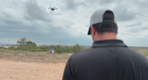
Defense. Surveillance and reconnaissance are probably the biggest military drone applications. Carrying payloads that include color video cameras and infrared night vision cameras, more than 19,000 drones are now in the arsenal of the U.S. Army, Air Force, Marines and Special Ops, and more have gone to other nations’ militaries.
Flying at relatively low altitude, with somewhat limited range and powered by a single quiet electric motor, these drones have become essential in gathering forward-situation intelligence.
Other UAV craft provide higher altitude, longer-duration surveillance and reconnaissance over wider range: up to 20 hours, up to 15,000 feet, more than 60 miles afield. Civilian versions of these craft are in development.
Delivery. Respondents to our survey thought delivery will be a breakthrough application for drones. Amazon has several trials running globably. National civil aviation authorities need to move forward with plans to integrate drones into civilian airspace for this initiative to graduate to full-scale operations and achieve their objective of 30 minutes from order to delivery.

Precision Agriculture. One of the most significant applications which seems to be missing from survey responses is agriculture. Both quadcopters and hybrid fixed-wing/copter drones are in widespread use to capture image data overflying crops, and then process the data and build crop analytics. Graphic results point to how crops can be managed to increase yield.
Making this work is a combination of sensor payloads gathering visual, video, lidar, thermal and hyperspectral data; the secret sauce lies in how the data is processed and presented to farmers. Emphasis is placed on exactly how “green” crops appear when inspected by the various sensors. A number of companies offer services for farmers to optimize crop management.
All these areas are show significant drone growth. Let’s not forget facility, transmission line and pipeline inspection — tasks where drones excel at increasing efficiency and decreasing costs.
For more results from the 2018 State of the GNSS Industry, see this page.
Tony Murfin is a GNSS aerospace consultant with several decades experience at leading companies in the GPS/aviation and OEM sectors.