No audio available for this content.
The three-way partnership will enable field crews to collect centimeter-accurate 3D data in GNSS-impaired environments.
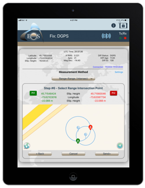
GNSS receiver maker Eos Positioning Systems has released a laser offset solution within the Esri Collector for ArcGIS workflow.
When combined with Laser Technology Inc.’s (LTI’s) laser rangefinders, the solution will allow field crews to capture centimeter-accurate 3D locations of hard-to-reach assets and in GNSS-impaired environments.
“By combining the high-accuracy of the Eos Arrow Series GNSS receivers and the laser capabilities of LTI, we can empower field crews to capture highly accurate XYZ coordinates from a safe distance,” LTI Senior Product Manager Derrick Reish said. “This eliminates the need for physically occupying every point. It also provides more accurate location data, with a more affordable mobile asset-management workflows.”
The solution has been in the works for months, as demand has grown for hard-to-reach, high-accuracy mapping within the Collector workflow.
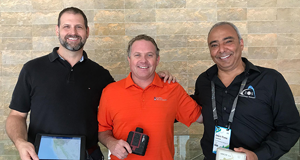
“Eos is extremely grateful to be a part of this initial release in high-accuracy asset location data with LTI’s laser rangefinders and Esri’s Collector mobile app,” Eos CTO Jean-Yves Lauture said. “Enabling this kind of accuracy means even the most budget-conscious field crews will be able to access the location of their hard-to-reach assets.”
All three teams have been working closely to ensure a seamless integration with Collector and ArcGIS Online. When using an LTI laser rangefinder and an Eos Arrow Series receiver with Collector, a field worker can easily shoot, capture and share high-accuracy 3D location data that is streamed into ArcGIS Online in real-time.
The solution is expected to be particularly useful in urban corridors, highway settings, forested (or wetlands) areas, and other areas where assets are hard or dangerous to occupy. This will both increase accuracy and efficiency, as well as decrease safety liabilities in dangerous situations, the companies said.
“Esri is extremely pleased that Collector can now support the capture of high-accuracy asset locations from afar, leveraging our unique partnership with both Eos and LTI,” Esri Product Manager Jeff Shaner said. “This is a game changer for asset management.”
Prior to this release, field crews challenged with capturing high-accuracy 3D locations for hard-to-reach assets would need to use a total station with a different software workflow and then mesh the data back in the office, a clumsy and inefficient workflow requiring lots of additional training and expertise. With the new workflow, field crews can operate in GNSS-impaired environments at a high-accuracy level without leaving the Collector/AGOL environment, creating a highly efficient workflow.
The solution has been designed to provide several offset-mapping methods.
“The implementation of several measurement methods gives users the freedom of choice, so they can pick the right laser option which meets their accuracy needs,” Reish said.
Eos will unveil its offset measurement solution for Collector at the upcoming Esri User Conference in San Diego. For a field demonstration of how the solution works, attendees can visit Eos at booth #1019 during the conference, and attend the session “LaserGIS for Everyone: How to Combat Costly and Tedious Data Collection Workflows” at 10 a.m. on Wednesday.


