No audio available for this content.
On Feb. 6, the United Nations Satellite Center (UNOSAT) announced via Twitter that it had activated emergency mapping services of Turkiye and northern Syria after the magnitude 7.8 earthquake hit earlier that day. The satellite images provide an overview of the damage, which can be used for humanitarian efforts and disaster relief, reported Space.com.
UNOSAT provides emergency mapping services, upon request, to provide satellite imagery analysis during emergencies and disasters. The maps show infrastructure that has been damaged during an emergency, which can then be used to provide relief by disaster response groups.
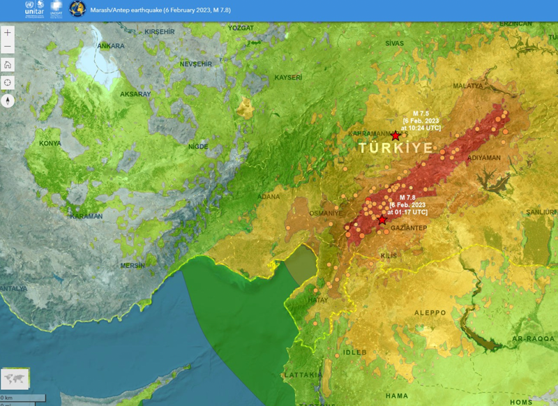
The earthquake caused massive destruction throughout Turkiye and Northern Syria, causing an estimated death toll of more than 19,000 as of Feb. 9. Several historical structures dating back thousands of years have also been severely damaged.
UNOSAT started in 2001 and is hosted by the European Organization for Nuclear Research. It does not operate its own satellites, but coordinates with United Nations member states to gather imagery from government agencies and privately owned satellites. United Nations offices, government agencies and relief organizations can request access to imagery collected by UNOSAT.
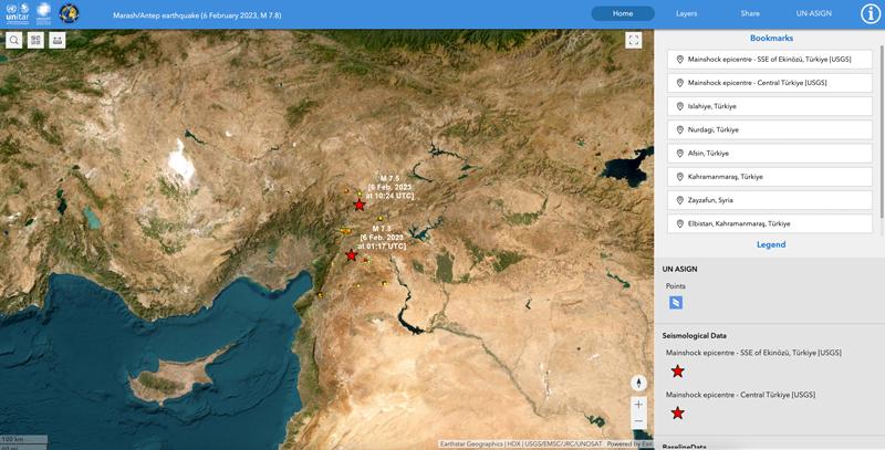
All maps of Turkey and northern Syria from UNOSAT can be found here. A live interactive map can be found here.
The Emergency Mapping service is activated over #Syria for the #earthquake west of Gaziantep – M7.8
➡️https://t.co/eoHKIGJEaS@IFRC @UNEnvoySyria @UNHCRinSYRIA @UNinSyria pic.twitter.com/HkyceJLOLQ— UNOSAT (@UNOSAT) February 6, 2023


