No audio available for this content.
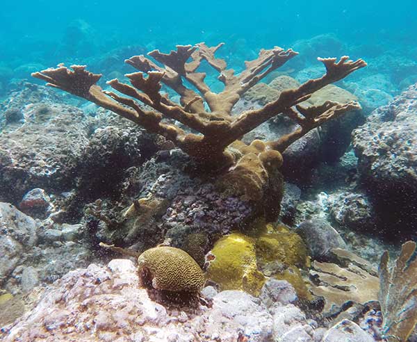
The Caribbean Division of The Nature Conservancy (TNC) has focused on monitoring, protecting and restoring the region’s marine environments for more than 40 years. As the plight of coral reefs has become more urgent, so too have TNC’s efforts to tackle coral conservation, and meet the demands for better maps.
“Reef maps are an essential tool for coral resource managers, but historically these maps have had insufficient detail, been outdated or been produced for small areas,” said Steve Schill, TNC marine conservation specialist. “Not having access to accurate, large-area reef maps has limited our understanding of these ecosystems and the benefits they provide.”
Having used Trimble’s eCognition object-based image analysis (OBIA) software for automatically classifying and mapping small reef areas, Schill believed eCognition could be the enabling, scalable approach to map the hundreds of thousands of reefs across the region.
Schill worked with technical professionals at Earth observation company Planet and researchers at Arizona State University to select 30,000 4-meter-resolution scenes from the Dove satellite constellation. The team then created a seamless mosaic of the whole Caribbean basin. He also partnered with eCognition specialists Tama Group to develop the OBIA method to automatically classify benthic habitats.
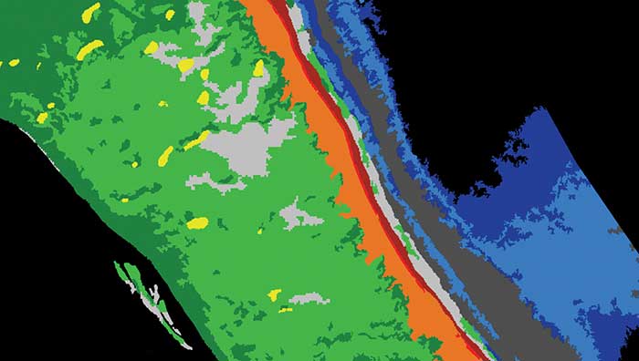
To map reefs, Tama Group experts integrated the Dove satellite surface reflectance and Dove-derived bathymetry into eCognition. The software first delineates land and sea areas deeper than 15 meters. Based on depth data and known topographic characteristics, it then categorizes the overall reef structure, distinguishing reef crest, fore reef, back reef, patch and fringing reef. Once it defines the five reef classes, eCognition determines seagrass classes (dense and sparse), sand types and dredged areas, and then finishes with mapping the deeper hard-bottom-with-algae classes. In total, the software automatically classifies 13 different benthic habitats.
Using this workflow, eCognition successfully classified the shallow water benthic habitats of the entire Caribbean Basin in four months. The software exported each area as vector shapefiles, and Schill and his team downloaded them for analysis and quality control. Moving from reef to reef, they used field data to analyze the accuracy of the classifications, making manual corrections where needed.
To date, benthic habitat maps have been produced for 23 countries and territories across the insular Caribbean. In October, the final full set of benthic habitat maps for the insular Caribbean will be available online.


