No audio available for this content.
For a major project, surveying with traditional GPS equipment would normally take many days, Learn how Trimble and Propeller helped speed progress.
Wills Bros, a family-run contractor based in the UK and Ireland, has begun work on the £29 million (USD $40 million) Maybole Bypass project in Scotland. The 6-km (~ 3.75-mi) project involves 900,000 cubic meters of earth removal and a further 15,000 cubes of rock that needs to be excavated and removed. In addition, Wills Bros is responsible for the construction of 10 culverts to deal with water flow in the area.
For a project this size, surveying the entire site with traditional, ground-based GPS equipment would normally take six days, estimates Jonathan Wills, who was instrumental in the company’s recent investment in Trimble and Propeller equipment. But considering the increased accuracy tolerance required for some of the structural elements involving the culverts, getting useful survey data from the ground would actually take weeks for this project.
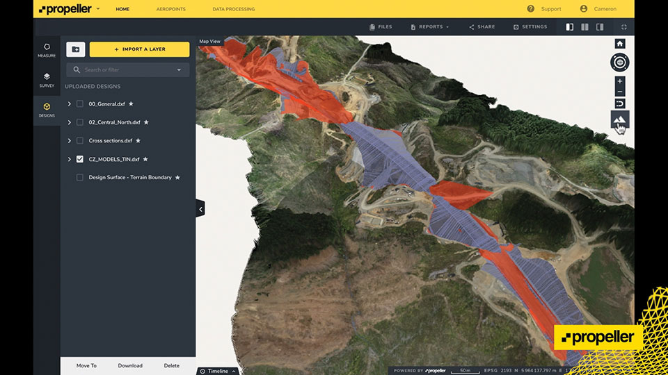
As an alternative, Wills Bros is using Propeller PPK, a drone surveying workflow that combines DJI’s Phantom 4 RTK drone; AeroPoints’ “smart” ground-control points; offloaded data processing; and the Propeller Platform software that allows measuring of the site using 3D models generated from drone images. Wills Bros also is using Trimble Stratus for cloud-based drone survey processing, visualization and analytics with Propeller Platform.
Wills Bros was able to collect an initial earthwork takeoff of the Maybole project area in a fraction of the time.
“Savings on labor costs alone have been considerable given the fact that on so many occasions we can now obtain detailed project data within a second rather than sending a man on site to survey for information,” Wills said. “The drone comes in a backpack and is up in the air doing its thing within minutes. From the outset, the time savings are immense.”
Once the drone and ground-control data are uploaded, Propeller transforms them into a 3D terrain model that can be measured in the cloud-based Propeller Platform.


