No audio available for this content.
City officials in Sarasota, Florida, kept their staff actively working during COVID-19 social distancing mandates by training and tasking them with mapping utility data in the field.
The city’s plan to rebuild its GIS database had an estimated five-year timeline. GIS Coordinator William Rockwell suggested to city manager Tom Barwin that those unable to work from home be trained to collect the data. Rockwell worked with Sarasota IT Director Herminio Rodriguez to calculate the cost of acquiring enough GNSS receivers for the idle staff to use, and discovered a substantial cost savings.
“By implementing this project, we not only keep city staff productive, but we’ll also be collecting data that would otherwise cost hundreds of thousands of dollars if we outsourced the work,” Rockwell said.
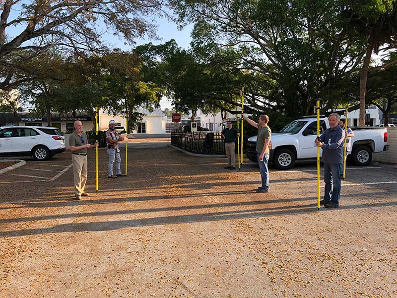
Training from a Distance. Rockwell obtained affordable Arrow 100 GNSS receivers from an Eos Positioning distributor and hosted small-group training sessions in the city hall parking lot. Employees from a multitude of different departments were trained, such as a parking enforcement officer and a transportation planner.
All employees were carefully kept six feet apart. From a maintained distance, Rockwell explained the basic concept of data collection using high-accuracy Arrow 100 receivers with ArcGIS Collector.
The employees took turns collecting sample data so Rockwell could address any initial concerns. He also gave each of them a printed map series, created in ArcGIS Pro, that showed the city divided into 28 grids. This allowed the team members to easily mark off where they collected data each day.
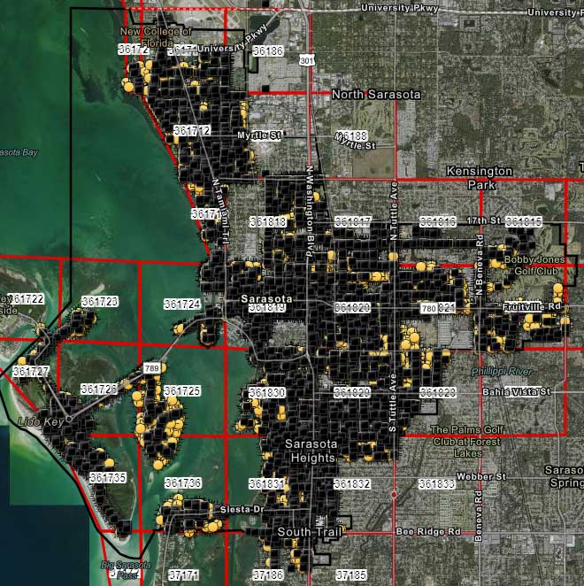
At the end of each day, the workers synced their data, collected by the Arrow 100s, to ArcGIS Online, which allowed Rockwell to monitor progress.
To date, 14 field workers have collected 93% of the city’s 6,000 street lights and 16,000 road signs. Although the 30-day project pilot has finished, the city plans to collect the remaining lights and signs, as well as the city’s 35,000 trees, later this year. High-accuracy GIS data collection has received encouraging feedback from management.
“I’m thrilled the city is supporting this initiative,” Rodriguez said. “To be able to take employees doing very, very different jobs and put them in the field — this wouldn’t have been possible in a normal environment. We are excited that everyone is chipping in.”


