No audio available for this content.

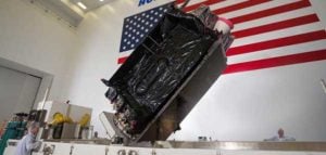
King Abdullah University of Science and Technology (KAUST) and Spire Global will launch the KAUST CubeSat research satellite by the end of 2022, according to the university. Spire is a space data, analytics and services provider.
The research satellite will in collecting high-quality, high-resolution data for terrestrial, coastal and ocean ecosystems for a three-year period after launch, according to Matthew McCabe, director of the KAUST Climate and Livability Initiative. McCabe described the launch as a qualitative process for the Kingdom’s efforts in the field of protecting and restoring ecosystems on land and at sea.
A CubeSat is a small satellite consisting of one or several 10x10x10 cm units, no more than 1.33 kilograms per unit. CubeSats can range from 1 unit (1U) to 12 units (12U). The KAUST satellite is 6U.
“In the past, launching a satellite was the sole domain of governments, with costs well beyond the reach of a university,” McCabe said. “CubeSats are helping to democratize space, providing the opportunity to launch a customized platform at a fraction of the traditional cost.”
The data collected will provide high-resolution details about current conditions of ecosystems in the region, and monitor improvements from environmental management strategies, supporting the Saudi Green Initiative among others.
The CubeSat is equipped with Spire’s GNSS reflectometry reflectors, as well as a hyperspectral imaging sensor. It is supported by advanced capabilities in processing and artificial intelligence.
The satellite will allow KAUST University researchers collect and analyze high-resolution images of the Earth’s surface for detailed mapping of terrestrial environments, monitoring of vegetation cover status, exploration of coastal ecosystems and coral reefs, development of precision agricultural research, and a host of other Earth and environmental science applications.
The imaging sensor can image areas of interest anywhere in the world across more than 30 user-adjustable spectral bands. The sensor data can be combined with Spire’s GNSS receiver to monitor micro-environmental variables such as soil moisture, helping in many areas such as agriculture, forestry and land management.
“The capacity to observe the Earth in high-resolution hyperspectral detail will allow for the production of enhanced metrics to map and monitor change anywhere in the world,” McCabe said. “Closer to home, Saudi Arabia is focusing considerable effort towards the protection and restoration of its precious terrestrial and ocean systems. The data from this KAUST CubeSat will be invaluable in providing new information on both the state of existing ecosystems, and for monitoring changes resulting from improved management strategies – something that can be used to support aspects of the Saudi and Middle East Green Initiatives.”