No audio available for this content.
RANGING

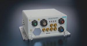
STOIC Technology to Augment or Substitute for GPS
The Defense Advanced Research Projects Agency (DARPA) selected Rockwell Collins to develop technologies that could serve as a backup to GPS. The research, being conducted as part of DARPA’s Spatial, Temporal and Orientation Information in Contested Environments (STOIC) program, aims to reduce warfighter dependence on GPS for modern military operations.
Rockwell Collins will develop new architectures and techniques to enable communication systems that will support time transfer and positioning between moving platforms independent of GPS, with no impact on primary communications functionality.
“STOIC technology could augment GPS, or it may act as a substitute for GPS in contested environments where GPS is degraded or denied,” said John Borghese, vice president of the Rockwell Collins Advanced Technology Center. “The time-transfer and ranging capabilities we are developing seek to enable distributed platforms to cooperatively locate targets, employ jamming in a surgical fashion, and serve as a backup to GPS for relative navigation.”
Borghese added that the goal of the STOIC program is to develop positioning, navigation and timing (PNT) systems that provide GPS-independent PNT, achieving timing that surpasses GPS levels of performance. The program is comprised of three primary elements that, when integrated, have the potential to provide global PNT independent of GPS, including long-range robust reference signals, ultra-stable tactical clocks, and multifunctional systems that provide PNT information among cooperative users in contested environments.
For this third technical element, Rockwell Collins is tasked with developing multifunction communication system solutions that yield DARPA STOIC objective picosecond-accurate time transfer and enable GPS levels of relative positioning accuracy in contested environments.
“Future applications of STOIC technology could include a variety of precision relative navigation operations, such as autonomous aerial refueling and cooperative navigation and collision avoidance within unmanned aerial vehicle swarms,” Borghese said. “It also could support precise time transfer for networking operations in contested environments.”
ELORAN
Wildwood eLoran Tests Continue
The Wildwood, N.J., eLoran 100-kHz transmitter continuously broadcast a signal from 0900 (EDT) on Oct. 20 through 1800 on Oct. 22, with plans to transmit further eLoran test signals from 0900 (EST) on Nov. 3 until 1200 on Nov. 6, and again from 0900 on Nov. 9 until 1500 on Nov. 13.
The purpose of these tests is to gather data on differential Loran performance in the Boston Metro and D.C. Metro areas. “Besides fixed eLoran receivers at our N. Billerica, Mass., and Leesburg, Va., offices, we also have additional fixed eLoran receivers located at the USNO and at the Harris Corporation offices in Herndon, Va.,” stated UrsaNav. The company also plans to gather temporal and spatial decorrelation data in both Metro areas. Note that these signals are for test purposes only and should not be used for any other purpose.
In May, Exelis, UrsaNav, the Department of Homeland Security’s Science and Technology Directorate (DHS S&T) and the U.S. Coast Guard entered into a cooperative research and development agreement (CRADA) for testing and demonstration at former Loran-C sites, including Wildwood. The team will evaluate eLoran as a potential complementary system to GPS.
The sites are the legacy ground-based radio navigation infrastructure of the decommissioned Loran-C service that could be retained and upgraded to provide eLoran low-frequency service.The broadcasts will provide a usable signal at a range up to 1,000 miles.
INERTIAL
MEMS Perspective on SatNav Gathering
By Alissa M. Fitzgerald
In September, I attended the Institute of Navigation GNSS+ 2015 conference, where I chaired a technical session on commercial
micro-electro-mechanical sensors (MEMS). As the founder of a MEMS product development firm, I was eager to gain perspective from the world’s largest technical meeting and showcase of satnav technology, products and services.
Overall, the navigation community is enthusiastic about integrating MEMS into navigation systems. They like the idea of getting more data from small, relatively low-cost sensors. Recently, U.S. Secretary of Defense Ashton Carter declared his wish that we move to MEMS-based position, navigation and timing (PNT) information.
What navigators want from MEMS depends on who they are.
The “high integrity” navigators — the people whose systems land airplanes or steer self-driving cars — would like MEMS sensors with enough performance to enable accurate inertial navigation without GPS for at least 10 minutes. If a GPS receiver can’t see at least four satellites in the sky, it can’t produce accurate navigation data. High integrity navigators are the original developers of sensor fusion systems; they know that no one sensor is perfect, so they design systems to detect loss of a reliable signal, and then adeptly switch between sensor data streams as needed to maintain accurate navigation information. Ten minutes of GPS-independent inertial navigation buys you enough time to get to higher altitudes, out of a tunnel or around a skyscraper, to a position that improves your view of the sky.
The “consumer” navigators — the people who want you to help them find the nearest Starbucks in downtown San Francisco — would like better low-cost MEMS gyroscopes and magnetometers, specifically with improved stability, to improve pedestrian inertial navigation. Although pedestrians are relatively slow-moving compared to vehicles, a key challenge to their accurate navigation is maintaining inertial position fixes while their smartphones unexpectedly change orientation: waving about in a person’s hand or sliding around in a purse or pants pocket.
It’s clear we MEMS people need to spend more time with these end-users, to first understand how MEMS will integrate with their other sensors and GNSS, and then to derive the essential MEMS sensor specifications for each specific navigation system and use case. The quest for seamless navigation has been and will continue to be an exercise in sensor fusion.
Alissa Fitzgerald is managing member, A.M. Fitzgerald & Associates, a MEMS consulting firm serving diverse industries.