No audio available for this content.
Digital twin technology emerged a decade ago to provide 3D virtual replicas of physical assets. Today, with Big Data and internet of things (IoT) capabilities, it is a complex and comprehensive method to support the construction of smart cities.
As a virtual model, a digital city can be an indispensable tool to visualize the life of a city in real time. It provides layered data about buildings, urban infrastructure, utilities, businesses, and the movement of people and vehicles. By providing this information, digital twins enable intelligent urban development and modernization.
Traditional methods of collecting and representing 2D spatial data, such as maps and images, are insufficient to meet the requirements for digital twin city models, where digital data provides the foundation for large-scale projects.
For example, the derived 3D models must have a high capacity to be merged and correlated with social or economic spatial data from IoT and Big Data. Because of this, a high demand exists for global, accurate, real-time geospatial data that provides high-precision 2D and 3D information.
Proof-of-concept
To illustrate a typical digital cities project, CHC Navigation (CHCNAV) carried out a proof-of-concept demonstration in the Jinshan district of Shanghai for one month in March and April.
The total area of the Jinshan district is approximately 600 km2. This area contains rich terrain features and typical characteristics of large, modern cities, such as high buildings, power lines, rivers and vegetation.

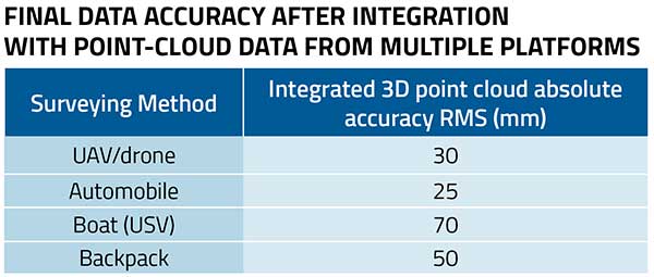
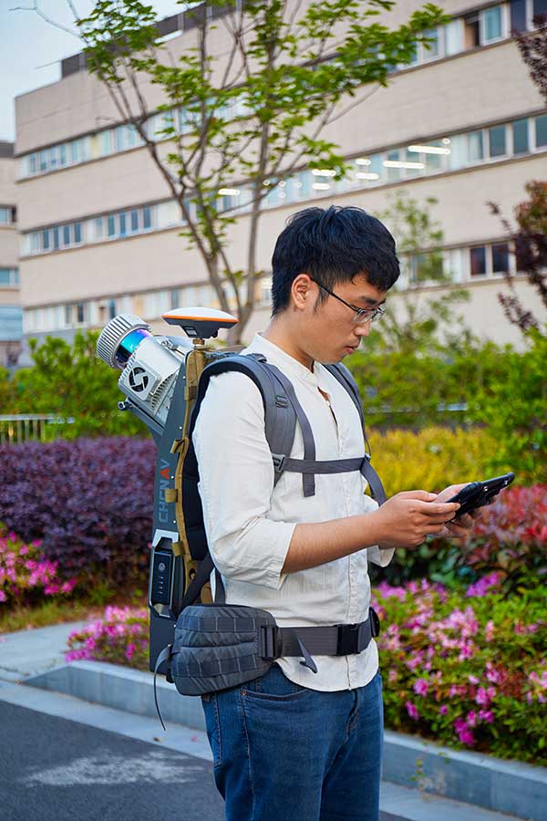
The traditional method of capturing with a single-platform lidar system may leave some areas blank in the point-cloud data. CHCNAV’s AlphaUni 900 lidar solution, with its multi-platform capability, was able to capture complete data with four different platforms: an unmanned aerial vehicle (UAV), a car, a backpack and a boat or unmanned surface vehicle (USV).
The AlphaUni series provides optimized data sets powered by advanced GNSS/inertial navigation system (INS) sensors and long-range scanners.
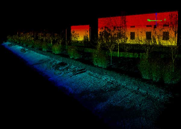
During the project, the CHCNAV AlphaUni 900 seamlessly integrated the district’s buildings in the data sets and provided a sophisticated 3D image from both indoor and outdoor environments. Its high-accuracy capability and multi-platform design can improve the way high-precision data is collected. It successfully provides an innovative solution for the problems of 3D geospatial data acquisition required for the development of smart cities.