No audio available for this content.
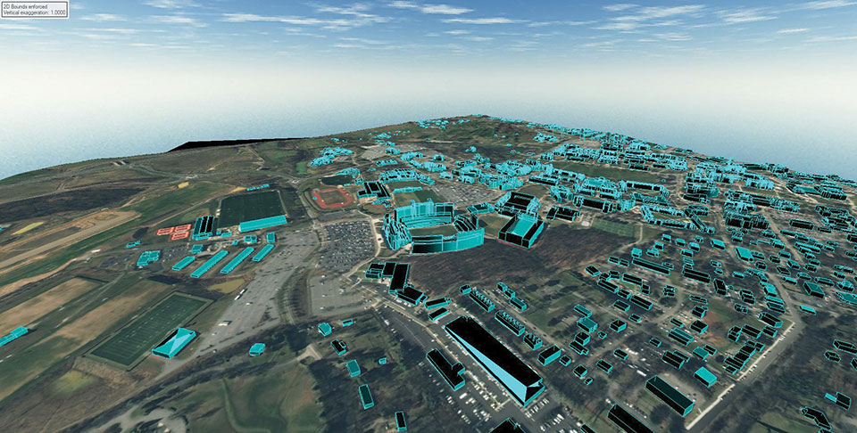
L3Harris provided a detailed digital map of Blacksburg, Virginia, to aid in the development of a Navigation Performance Forecast for UAVs, specifically for beyond-visual-line-of-sight flights.
L3Harris used a novel method of 3D map generation using a deep stack of high-resolution satellite imagery and artificial-intelligence technology without the time or expense of a site visit. This detailed mapping technology, known as multi-view photogrammetry, was used in a pilot study to determine the viability of using modern, automated, mapping technologies to build a scalable methodology that can be applied to very large-size mapping programs, potentially covering the urban areas of North America and Western Europe.
The company is using these 3D maps with its GNSS forecast technology to accurately predict GPS performance for UAS flight planning and operation. This prediction helps the unmanned aircraft service supplier and UAS operator ensure safe operations.
The L3Harris Geospatial Data Products team provided 2D and 3D products, including the vector map shown above.


