No audio available for this content.
As a UAV flies, it is subject to roll, pitch and yaw movements, adversely affecting the high-definition imagery that industrial-grade UAVs are designed to collect. Three measures combat unwanted movement: a stabilizing gimbal, a high-quality GPS/inertial measurement unit (IMU) integration, and orthorectification of the data during post-processing.
Imaging applications are driving all sectors of the booming UAV market. The increasing availability and variety of compact, robust, lightweight sensors, employing a range of super-resolution and often multi-spectral and hyperspectral technologies, continuously expand and improve UAV applications.
Three companies exhibiting at the Association for Unmanned Vehicle Systems International’s (AUVSI’s) massive Xponential show May 1-3 will showcase recent advances in this arena.
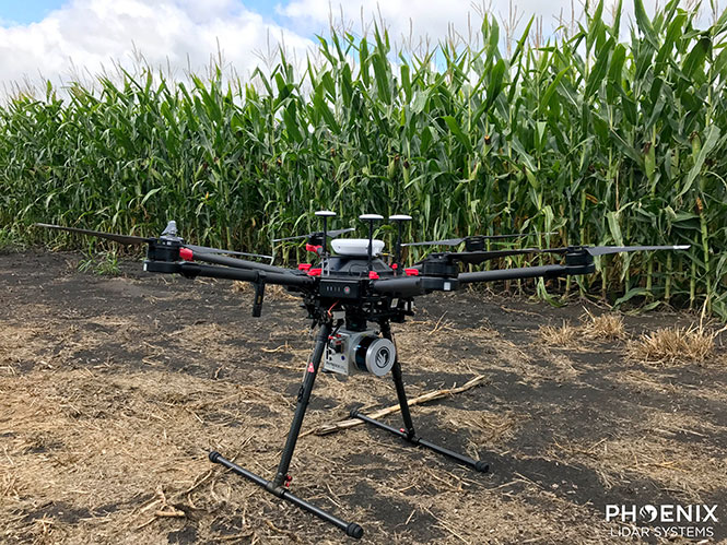
Challenges of Airborne Imaging. Size and weight govern UAV deployment.Imaging sensors must fit compact payload bays. An integrated UAV solution will typically include an imaging sensor, a high-performance GPS/inertial measurement unit (IMU), and a data storage hub to collate streams of data from all connected instruments.
Software geared specifically to flight supplies image orthorectification and manages sensor operation during the mission, enabling users to input GPS coordinates for sensor operation. Outside of defined coordinates, the sensor will not collect data, reducing the amount of data to store or transmit.
Immediate or real-time processing and georeferencing of imaging products has always been key to defense and security applications; it becomes critical for precision agriculture, cartography, civil engineering, remote monitoring and surveillance, intelligent inspection, disaster preparedness and risk study, newsgathering, cinematography, tourism and even commercial advertising. A multisensor landscape view can improve a UAV’s ability to react intelligently without operator input.
Integrated GPS/INS exhibitors at the Xponential show include:
NovAtel (Booth 3219). The company uses a flexible technology platform and diverse OEM products, which include SPAN technology: tightly coupled GNSS receivers with IMUs for reliable, continuously available, position, velocity and attitude, to deliver its vision of assured positioning — anywhere.
NovAtel offers TerraStar Correction Services to provide accurate real-time sub-meter or decimeter positioning around the world, anytime. Its Waypoint Inertial Explorer Xpress post-processing software provides the same core processing and utilities as Inertial Explorer along with simplified functions and workflows tailored for UAV markets and small project areas.
VectorNav (Booth 2214). Engineers at Octopus ISR integrated the VectorNav VN-200 GPS/INS directly into the optical bench of a gimbal to deliver positioning accuracy under flight conditions such as high vibrations, accelerations and temperature fluctuations. The device flies aboard the UAV Factory’s miniature Epsilon series of gyro-stabilized gimbals, enabling the Precision Geo-Lock feature, which combines a GPS-aided inertial navigation system with dedicated software algorithms and payload operator software.
The VN-200 features 16g accelerometers and 2000°/sec gyros in a postage-stamp-sized surface-mount device and a rugged package. Epsilon gyro-stabilized turrets are available with both VectorNav’s VN-200 single GPS-based INS solution and the VN-300 dual GPS-based INS.
SBG Systems (Booth 2535). The company developed specific calibration procedures to provide reliable heading even when UAVs tilt. Magnetometer calibration can be processed in 2D on the ground, or in 3D in flight. Qinertia software enhances inertial navigation systems performance by post processing inertial data with raw GNSS observables.
SBG Systems’ Ellipse 2 Micro high-performance inertial sensors reduces size and costs and for volume projects. It is available as an inertial measurement unit (IMU), or as an attitude and heading reference system (AHRS) or inertial navigation system (INS) running an extended Kalman filter, connected to an external GNSS receiver.


