No audio available for this content.

SPH Engineering and AirData UAV have partnered to offer pilots a way to track and manage their fleets by automatically synchronizing flight data from SPH Engineering’s UgCS to AirData.
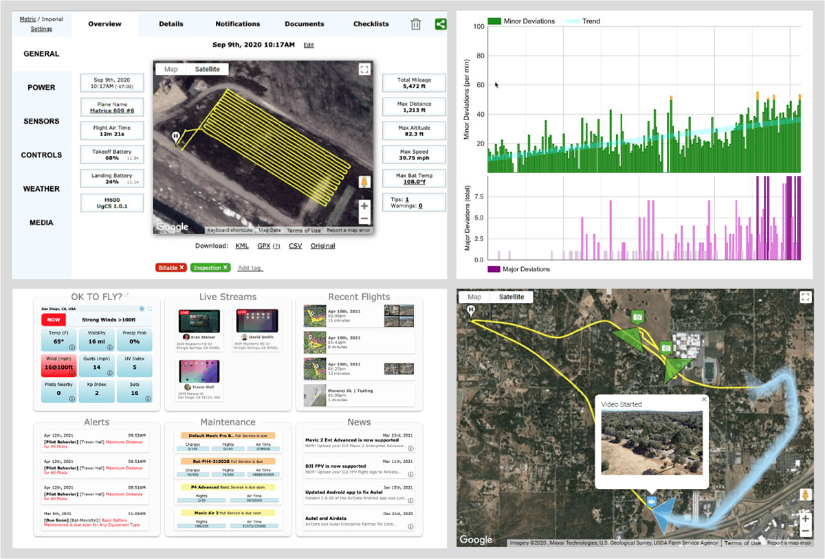
SPH Engineering and AirData have worked closely to provide an automatic method to synchronize flight logs with AirData. The new integration will transmit detailed and comprehensive flight information from UgCS and will leverage AirData’s crash prevention algorithms, pilot and equipment alerting, as well as maintenance tracking with no manual steps required.
UgCS by SPH Engineering is a tool for enhanced UAV mission planning and flight control software solution. Today, it is used in more than 150 countries in a wide range of areas including environmental, archeological, engineering and mining, agricultural and biological. The UgCS Educational program aims to support universities with a safe and efficient tool to test innovative ideas involving surveying and inspecting with a drone. SPH Engineering is a multiproduct drone software company and UAV integration services provider.
AirData is an online drone fleet data management and real-time flight streaming platform, serving more than 200,000 users with 19 million flights uploaded to date, processing an average of 20,000 flights a day, with high-resolution data stored per each flight. It is used by large fleet operators around the world not only as a logbook, but also as a comprehensive flight safety data analysis and crash prevention platform, with advanced maintenance, pilot tracking and live streaming.