No audio available for this content.
In my column for the July 2026 issue of GPS World’s Survey Scene newsletter, I reported that NOAA’s National Geodetic Survey (NGS) had solicited a contract to align non-NOAA CORS with the new National Spatial Reference System (NSRS). That contract has now been awarded, and Dr. Demian Gomez of The Ohio State University is serving as project manager. I met with Demian in Columbus last month to discuss his implementation plans.
My July 2026 column outlined the contract’s scope and its implications for managers of CORS and Real-Time Network (RTN) systems. This column focuses on how the project will be implemented — specifically, what data users must supply and how to submit them. For background on the contract (NGS CORS Processing Development) please see my July 2026 column.
The official project title is “Alignment of Continuously Operating Reference Stations (CORS) Processing and Coordinate Products,” now referred to as the ACORS project.
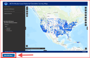
A note for non-NOAA CORS/RTN providers who included their sites in OPUS projects to be part of the first national adjustment and receive Reference Epoch Coordinates (RECs): that was a smart step, but I still recommend submitting your CORS data to ACORS. This process will yield more accurate RECs with improved, consistent accuracy estimates aligned to the latest NOAA CORS Network (NCN) coordinates. It will also help to help validate NGS’s Intra-Frame Deformation Model (IFDM), which is critical to estimating RECs near your local CORS. I’ll cover this in more detail later in the newsletter. For those concerned about coordinate inconsistencies, the updated RECs will be published through NGS’s data delivery system. See my column in the October 2026 issue of this Survey Scene newsletter for information on NGS’s beta data delivery system. As I’ve noted before, please review NGS’s beta products and send feedback — NGS is listening and aims to provide user-friendly tools for adopting the new reference frames.
Key deadline:
- Data received by December 15, 2026, will be included in the first processing run and will be eligible for publication when NGS officially releases the new NSRS. Additional submission windows will follow as the project progresses.
What do providers need to do?
At the end of this column, I’ve included a draft prepared by Demian titled “Alignment of CORS Information Page.” It will be available to everyone once the sites officially launch.
Here are the key steps for which providers should begin preparing:
- Required submission package. Before a station can be included, providers must submit a complete package that includes:
- A filled-out station workbook (standard site/metadata details typically known to CORS/RTN operators).
- GNSS observation data for two distinct time periods.
- Streamlined process. The submission workflow is being designed to make it as straightforward as possible to supply both station information and data.
| Station Workbook Required information includes: ● Organization and technical contacts ● Station and network identifiers ● Approximate station coordinates ● Monument and reference-point information ● Receiver, antenna, radome, firmware, and antenna-height histories ● Available years of GNSS observations ● Data-server or transfer information ● Real time network membership, when applicable ● NGS permanent mark identifier (PID), if the station was previously bluebooked |
| GNSS observation data Required information includes: 24-hour daily RINEX files with a sampling interval of 30 seconds for both standard periods: Primary alignment period ● December 18–31, 2019 ● January 1–14, 2020 Recent validation period ● December 18–31, 2025 ● January 1–14, 2026 |
If you lack data for the required periods and need to propose alternate dates, you’ll be able to contact the project team to discuss your case.
Why Data from Two Time Periods?
The primary alignment period of December 18–31, 2019 to January 1–14, 2020
The primary alignment spans December 18–31, 2019 and January 1–14, 2020, bracketing January 1 and yielding coordinates at the mean date of January 1, 2020 (epoch 2020.0).
The validation period of December 18–31, 2025 to January 1–14, 2026
The validation window covers December 18–31, 2025 and January 1–14, 2026 (two weeks before and two weeks after January 1), providing the best estimate of the coordinate on January 1, 2026 (epoch 2026.0). This data can be used to validate the Intraframe Deformation Model (IFDM). The Euler Pole Parameters (EPP) and IFDM will then be used to transform the January 1, 2026, coordinate to January 1, 2020 (epoch 2020.0), which will be compared with the coordinate derived from the primary alignment period to evaluate the models.
How Will the Data be Input and Processed?
The Ohio State University GeoDE Interface of GNSS Data
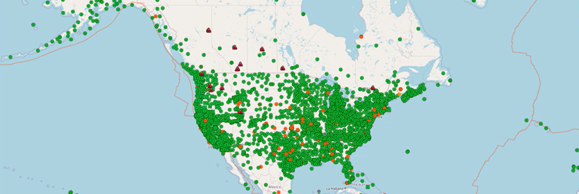
The Ohio State University (OSU) has developed GeoDE (Geodetic Database Engine), an open-source platform for managing GNSS stations, their metadata, and geodetic data processing. GeoDE features an interactive station map with spatial and temporal filters and supports parallel processing with GAMIT/GLOBK, GPSPACE, and PRIDE-PPPAR. It generates time series and trajectory models for deformation analysis.
Learn more in OSU’s GeoDE video series: https://www.youtube.com/watch?v=7UMAe4wiySk
- Episode 1 tours GeoDE Studio—navigating the main interface and exploring the station map that displays every station in the database.
- Subsequent episodes cover station metadata, instrument histories, field visits, data availability, time series, and more.
Stations contributed by participants in the NGS contract project will be incorporated into OSU’s GeoDE website.
| |
Why has NGS contracted for this service and who can participate?
The National Geodetic Survey’s current multi-year CORS Solution (MYCS) omits many stations operated by real-time networks and other organizations across the United States. As noted in my July 2026 column, this has important implications for managers of non-NOAA CORS and RTN systems. To close this gap, NGS launched the Alignment CORS (ACORS) project and contracted with The Ohio State University (OSU) to process and validate eligible stations with complete, usable submissions, delivering coordinate products aligned to ITRF2020 at epoch 2020.0 and consistent with the modernized NSRS.
Who Can Participation?
Participation is open and voluntary. Submitting a station will not add it to the NOAA CORS Network (NCN), but it will produce an official, vetted coordinate set in the modernized NSRS. Network operators are encouraged to submit non-NCN stations.
Eligibility and requirements:
- Who can participate: Any organization or station owner operating a permanent GNSS reference station in the United States or a U.S. territory that is not already included in a current NGS multi-year or IGS coordinate solution.
- Bluebooked stations: Non-NOAA CORS with existing PIDs (“blue-booked”) are encouraged to be included.
- Not eligible: Temporary stations.
- What’s required: Complete station metadata and the required GNSS observation data must be provided before an eligible station can enter the processing queue.
How do You Contact the Project Team?
Organizations interested in participating should first provide their organization’s name, technical contact, network name, approximate number of stations, available observation periods, and preferred transfer method. In the next week or so, the contact information listed below will be available but until then everyone should contact Demian Gomez (https://earthsciences.osu.edu/people/gomez.124) at gomez.124@osu.edu.
Contact information:
Project email: alignment.cors@noaa.gov
OSU contact: Demian Gomez (https://earthsciences.osu.edu/people/gomez.124)
Info page: https://go.osu.edu/alignment-cors-info
Data portal: https://go.osu.edu/alignment-cors
| Alignment of CORS Information Page NGS Alignment CORS Project: Voluntary Call for Data Modernized NSRS Coordinates for CORS Outside Current NGS and IGS Solutions Adopting the modernized National Spatial Reference System requires coordinates expressed in the new terrestrial reference frames. Current National Geodetic Survey (NGS) multi-year Continuously Operating Reference Stations (CORS) Solution (MYCS) and International GNSS Service coordinate solutions do not include many of the Continuously Operating Reference Stations that are operated by real-time networks and other organizations. The National Geodetic Survey created the Alignment CORS Project (ACORS) to address this gap. Through this project, NGS contracted with The Ohio State University (OSU) to process and validate eligible stations with complete, usable submissions and produce coordinate products aligned to ITRF2020 at epoch 2020.0 and consistent with the modernized NSRS. Participation is voluntary. Participation does not add a station to the NOAA CORS Network (NCN), but it does result in a formal set of vetted coordinates at a station in the modernized NSRS. Network operators are encouraged to submit non-NCN stations, and they may also submit NCN stations that were not part of the most-recent MYCS completed by NGS. The project is designed to process many stations, but its capacity is finite. Submitting station information does not guarantee processing. Complete, eligible submissions will enter the processing queue in the order in which they were received and will be processed in batches until project capacity is reached. Who May Participate. Participation is open to any organization or station owner operating a permanent GNSS reference station located in the United States or a U.S. territory that is not included in a current NGS multi-year or International GNSS Service coordinate solution. Stations that have been “blue-booked” and have existing PIDs with NGS are encouraged to be included in the submission. Temporary stations are not eligible. Operators must provide the required observation data and complete station metadata before an eligible station can enter the processing queue. Submit as soon as possible. Submissions will be processed in multiple rounds, with each round handled on a first-come, first-served basis. First proposed submission deadline: December 15, 2026. Additional deadlines will be announced. OSU is ready to begin processing now. Complete submissions will enter the processing queue as they arrive and will be handled in batches. Submit by this initial deadline to have coordinates before or shortly after the roll-out of the new NSRS. Processing capacity is limited. The project will accept complete, eligible submissions on a first-come, first-served basis until available capacity is reached. Waiting until the deadline may result in a submission arriving after the project has reached capacity. An expression of interest, partial upload, or incomplete workbook does not reserve a place in the queue. A station enters the queue only after OSU receives a complete and usable submission. Required submission package Station workbook Complete the NGS and OSU station workbook. Required information includes: ● Organization and technical contacts ● Station and network identifiers ● Approximate station coordinates ● Monument and reference-point information ● Receiver, antenna, radome, firmware, and antenna-height histories ● Available years of GNSS observations ● Data-server or transfer information ● Real time network membership, when applicable ● NGS permanent mark identifier (PID), if the station was previously blue-booked GNSS observation data. Provide 24-hour daily RINEX files with a sampling interval of 30 seconds for both standard periods: Primary alignment period ● December 18–31, 2019 ● January 1–14, 2020 Recent validation period ● December 18–31, 2025 ● January 1–14, 2026 Do not substitute other dates unless the project team requests them. Stations commissioned after January 2020. If a station was not operating during December 2019 and January 2020, provide the earliest complete December–January period available after commissioning. For example: ● December 18–31, 2020 and January 1–14, 2021 for a station that came online between January and December 2020 or ● December 18–31, 2021 and January 1–14, 2022 for a station that came online between January and December 2021 or ● The corresponding period for the first available year for the station. Also provide the December 2025–January 2026 validation period if the station was operating at that time so that the team can validate the results. If the station has not operated through a complete standard December–January period, do not submit an arbitrary replacement period. The station may need to wait for a future processing opportunity. Supporting records. Include: ● The provided template spreadsheet filled out with all the requested information OR IGS site logs covering every observation period ● A list of PIDs or published NGS datasheets for Blue-booked stations, when available ● A file inventory identifying the submitted datasets ● A README explaining the directory structure, file naming, compression, missing data, and known station issues. Organizations may also provide relevant local velocity models or other technical information for evaluation. Complete submissions are required. The submitting organization is responsible for providing accurate, complete, and usable data and metadata. NGS and OSU do not have resources to locate missing observation files, reconstruct station histories, resolve undocumented equipment changes, or provide individual assistance assembling submissions. Incomplete or unusable submissions will not be processed. If OSU identifies a deficiency, the station will enter the processing queue only after the submitting organization provides the corrected and complete package, subject to remaining project capacity. Data transfer. Organizations with an accessible FTP, SFTP, HTTP, or HTTPS server may provide retrieval information to OSU. Organizations without a data server may use the OSU Geodetic Database Engine (GeoDE) upload portal after receiving submission instructions. OSU will provide transfer instructions for exceptionally large datasets on a case-by-case basis. Passwords and server credentials must be exchanged through an approved secure method. Do not include credentials in the station workbook or send them through ordinary email. Project deliverable For each station accepted and successfully processed, the project expects to produce a coordinate record that includes: ● Coordinates aligned to modernized NSRS at epoch 2020.0 ● Coordinate uncertainties and quality informatio ● Supporting station and processing metadata ● Processing and validation status ● Any identified limitations or unresolved issues Submission does not guarantee that a station will produce an acceptable coordinate or that it will be processed before project capacity is reached. If a station with a PID contributes to the ACORS, the results of ACORS will supersede the coordinates determined via the national 2020.0 Reference Epoch Coordinate (REC) adjustment if all the conditions above are met. Submission instructions. Before releasing this data call, NGS and OSU will confirm the submission email, OSU contact, upload portal address, and secure method for exchanging server credentials. Contact the project team. Organizations interested in participating should first provide their organization name, technical contact, network name, approximate number of stations, available observation periods, and preferred transfer method. Project email: alignment.cors@noaa.gov OSU contact: Demian Gomez, https://earthsciences.osu.edu/people/gomez.124 Info page: https://go.osu.edu/alignment-cors-info Data portal: https://go.osu.edu/alignment-cors |