Where have all the flowers gone? Mapping tool shows crop devastation of Ukraine war
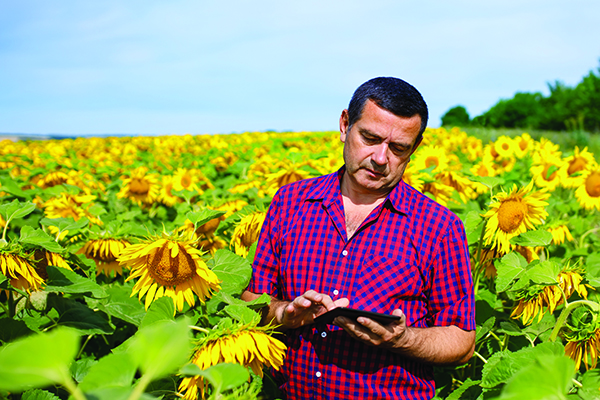
Sunflowers — soniashnyk in Ukrainian — have been grown in Ukraine since the mid-18th century. Besides being a popular snack, growing the flower for export helps fuel Ukraine’s economy. Before the war, Ukraine and Russia supplied up to 80% of the world’s sunflower oil exports.
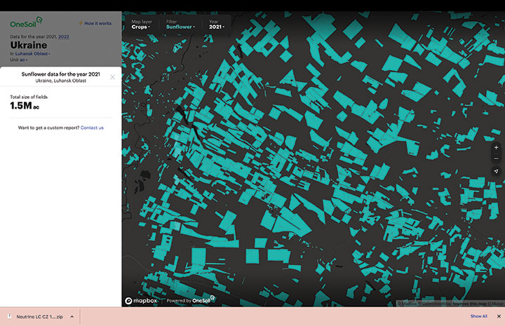
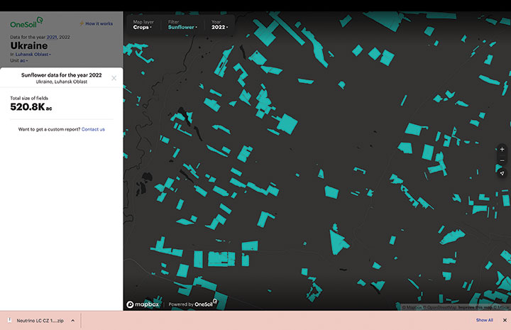
With the Russia invasion, however, sunflower and other crops have suffered, with growth of spring crops declining as much as 40% in the eastern Donbas region hit especially hard by the war.
OneSoil Map, by OneSoil, is a new, powerful data visualization and mapping tool that combines proprietary artificial intelligence (AI) with satellite imagery to map crops worldwide. It enables agricultural businesses to visualize massive datasets and deliver insights on a global scale. Another tool, the OneSoil application, helps farmers remotely monitor crop health, detect issues and apply fertilizers and seeds, increasing yields and boosting sustainable farming practices.
In Ukraine, satellite imagery and AI-based technologies are helping farmers face shortages and a population confronting food insecurity. OneSoil compared 2021 and 2022, and found the area used for the country’s spring crops — corn and sunflower — have decreased by 40% in wartorn regions, with the greatest decrease in Kharkiv (–59%), Donetsk (–58%), Luhansk (–57%) and Zaporizhia (–43%).
Corn is an export crop that accounts for 16% of the global market. OneSoil Map showed its overall acreage in the main corn production areas (Chernihiv, Poltava, Sumy) has dropped by 19% to 36%, depending on the region.


Follow Us